Wednesday, 22 October 2025

The Statistical Improbability of a Ramson Cliff Glacial Erratic

Detection of an Outlier in Glacial Erratic Elevations in North Devon
Author’s Note (Revision – 11 April 2026)

This article has been completely rewritten in response to constructive criticism of my original post (“The statistical improbability of a Ramson Cliff glacial erratic”, 22 October 2025). I fully acknowledge that the earlier version contained unintended ambiguity in the description of the dataset, particularly the phrasing around “Croyde–Saunton Foreshore Erratics” and “approximately 30 additional” boulders from Madgett & Inglis (1987). This could reasonably have been read as double-counting or artificial weighting of low-elevation data points, even though there was no actual double counting or artificial weighting. I apologise for any confusion this caused. The conclusion of the exercise is unchanged.

In this revised version every data source is stated explicitly, the construction of the dataset is described step-by-step, and no boulders are counted twice. The statistical tests themselves remain unchanged in method, but the dataset is now fully transparent and reproducible. The purpose of the analysis is solely to explore the relative distribution of recorded elevations within the published North Devon erratic record.

Abstract

Glacial erratics in North Devon provide valuable insights into Pleistocene ice dynamics, with their elevations above Ordnance Datum (OD) serving as proxies for depositional processes. This study analyses a dataset of 49 erratic site elevations (ranging from 5 to 80 m OD), drawn from two source categories: 37 boulders catalogued by Madgett & Inglis (1987) and 12 individually documented sites or exposures from other geological records, these are all the claimed glacial erratics in the area discovered from a deep literature search. Of the Madgett & Inglis catalogue, 36 are foreshore or raised-platform boulders, here assigned a nominal elevation of 5 m OD; the 37th is the Ramson Cliff epidiorite (No. 8) at ~80–85 m OD. The Ramson Cliff value is flagged as anomalous by Z-score, Grubbs’ test, and Dixon’s Q test (all at α = 0.05). The IQR method, though it also flags 80 m OD, is uninformative for this dataset: the dominance of the 5 m OD cluster compresses the IQR to zero, causing it to flag every value above 5 m OD indiscriminately. Only boulders with high or medium context security — those in demonstrably undisturbed depositional settings — are included; two further high-altitude Baggy Point boulders (at ~45 m and ~60 m OD) are excluded on this basis. The results underscore the need for further verification of the Ramson Cliff erratic’s depositional context, while the bulk of values align with coastal and estuarine deposition.

Keywords: Outlier detection, glacial erratics, Grubbs’ test, Dixon’s Q test, North Devon, Saunton–Croyde suite, context security

Introduction

Glacial erratics — boulders transported and deposited by ice — offer palaeoenvironmental evidence, particularly in regions like North Devon, UK, where Devensian ice limits are debated. Elevations above sea level (m OD) can indicate transport modes, with low-level coastal erratics (e.g., Saunton Sands) suggesting marine reworking, and higher inland examples implying direct glacial deposition.

Data sources

The most complete published record of North Devon glacial erratics is the catalogue of Madgett & Inglis (1987), who documented 37 boulders (long axis ≥25 cm) in the Saunton and Croyde areas with grid references, dimensions, and lithologies. Of these, 36 (Nos. 1–7, 9–37) were found on the foreshore, raised shore platforms, or in beach and raised-beach contexts, and are described as lying below 30 m OD; individual altitudes are not given except for No. 8, the Ramson Cliff epidiorite on Baggy Point at ~80–85 m OD (Daw, 2026). A further 12 site or exposure elevations are drawn from other geological records (see Table 1).

Two further high-altitude boulders on Baggy Point — a tuff/agglomerate at ~60 m OD and another at ~45–46 m OD, documented by Berry (2021) and Madgett — are excluded from this analysis. Both were ploughed from fields and placed on stone walls in the late 1980s–1990s; their context security is low, meaning their recorded positions cannot reliably be taken to reflect original glacial emplacement. Their existence is noted here for completeness.

Inclusion criterion: context security

This analysis includes only boulders assessed as having high or medium context security, meaning they are in situ or in demonstrably undisturbed (or minimally disturbed) depositional settings. Boulders known to have been relocated by agricultural activity are excluded, as their present elevation cannot serve as a proxy for glacial deposition height. The Ramson Cliff erratic (No. 8), though flagged by Madgett & Inglis (1987) as having been ploughed and possibly moved, is retained as the subject of the outlier analysis; its low context security is itself part of the reason its elevation warrants scrutiny.

Dataset construction

For the 36 Madgett & Inglis foreshore boulders, individual altitudes are not published. For the purposes of this statistical exercise, each is assigned a nominal elevation of 5 m OD to approximate sea-level deposition. This is a deliberate simplification: assigning a single value to all 36 creates a large artificial cluster at the low end of the distribution. This has significant consequences for the summary statistics and for the IQR-based test in particular, as discussed below.

Table 1. Erratic site/exposure elevations used in this study (n = 49). The 36 Madgett & Inglis foreshore boulders are entered as a single aggregate row; the 13 individually documented sites are listed separately.
Site/Exposure Elevation (m OD) n Source Notes
Madgett & Inglis foreshore erratics (Nos. 1–7, 9–37)5 (nominal)36Madgett & Inglis (1987)Foreshore and raised-platform boulders; all <30 m OD; individual altitudes not published; 5 m OD assigned as sea-level approximation
Ramson Cliff Erratic (No. 8, Baggy Point)801Madgett & Inglis (1987)~80–85 m OD; context security low (ploughed/moved; possible manuport). Retained as subject of outlier analysis
Saunton Sands (micro-granite erratic)51Other geological records
Freshwater Gut (coastal erratic)7.51Other geological records
Bickington Pits (Tews Lane Pits)151Other geological records
Combrew Farm Pit151Other geological records
Chilcotts Farm Pit151Other geological records
Roundswell Well-Boring151Other geological records
Fremington Railway Cutting151Other geological records
Brannam’s Clay Pit (Higher Gorse)251Other geological records
Barnstaple Bypass Cutting (Lake Cutting)251Other geological records
Clampitt Workings251Other geological records
Head Deposits near Brannam’s251Other geological records
Westonzoyland (Somerset Levels)51Other geological records

The resulting dataset of 49 values has the following frequency distribution: 5 m OD × 38, 7.5 m OD × 1, 15 m OD × 5, 25 m OD × 4, 80 m OD × 1. All 48 values excluding Ramson Cliff fall within the 5–25 m OD range (98.0% of the dataset). The single value at 80 m OD stands as a potential outlier.

A Shapiro–Wilk test yields W = 0.40, p < 0.001, indicating severe non-normality. This is not driven solely by the 80 m OD value: 78% of the dataset consists of a single repeated value (5 m OD), a direct consequence of the nominal-elevation assignment. The distribution is fundamentally unlike a normal one. This has implications for the Z-score and Grubbs’ tests, which assume normality, as discussed below.

The objective is to apply four standard outlier detection methods — the IQR rule, Z-score, Grubbs’ test, and Dixon’s Q test — to assess whether the Ramson Cliff value warrants further field investigation.

Methods — Application of Standard Outlier Tests

Data Preparation

Elevations were treated as a univariate sample (n = 49). Descriptive statistics were computed: mean (μ), sample standard deviation (s), first quartile (Q1), third quartile (Q3), and IQR = Q3 − Q1.

Outlier Tests

  1. IQR Method: Flag values > Q3 + 1.5 × IQR or < Q1 − 1.5 × IQR. This non-parametric approach is robust to non-normality but is sensitive to data compression: when a large majority of values are identical, Q1 and Q3 converge, producing a zero IQR and fences that flag any deviation from the dominant value. In this dataset, that limitation is fully realised.
  2. Z-Score: Compute z = (x − μ) / s for each value. Flag if |z| > 3 (common threshold for n ≈ 30–50). Assumes approximate normality.
  3. Grubbs’ Test (One-Sided, Upper): For the suspected maximum outlier, test statistic G = (max − μ) / s. Reject H₀ (no outlier) if G > Gcrit, where
    Gcrit = [(n−1)/√n] × √[t² / (n−2 + t²)],
    t = t1−α, n−2 (from the t-distribution, one-sided). Here, α = 0.05. Like the Z-score, this test assumes approximate normality.
  4. Dixon’s Q Test: Q = (max − second max) / (max − min). Reject if Q > Qcrit. Caveat: Dixon’s Q test is designed for small samples (typically n ≤ 25; some tables extend to n = 30). Its application to n = 49 is an extrapolation well beyond the test’s intended range, and the critical value used (≈0.38) is an approximation. Results should be treated as indicative rather than formally valid.

All computations used Python 3.12 with NumPy and SciPy libraries.

Results

Descriptive Statistics

Table 2. Summary statistics for the full dataset (n = 49).
StatisticValue
Mean (μ)9.23 m OD
Median5.00 m OD
Sample std. dev. (s)11.95 m OD
Q15.00 m OD
Q35.00 m OD
IQR0.00 m OD
Upper IQR fence (Q3 + 1.5 × IQR)5.00 m OD
Lower IQR fence (Q1 − 1.5 × IQR)5.00 m OD

Because 38 of the 49 observations are at 5 m OD (78%), Q1 and Q3 are both 5.00, producing an IQR of zero. The upper and lower fences collapse to 5.00 m OD, meaning the IQR method flags every value that is not exactly 5 m OD. This is a well-known failure mode of the IQR method when applied to heavily tied data, and the result is uninformative for distinguishing genuine outliers from normal variation.

Outlier Test Results

Table 3. Outlier test results.
Test Test Statistic Critical Value (α = 0.05) Result
IQR (upper fence)Upper fence = 5.00 m ODAll values above 5 m OD flagged (11 observations); method uninformative due to zero IQR
Z-Score (max)z = 5.92 (for 80 m OD)3.0080 m OD flagged; no other value exceeds 3
Grubbs’ G (one-sided upper)G = 5.92Gcrit ≈ 1.63Reject H₀ (p << 0.001)
Dixon’s Q (r10)Q = 0.73≈0.38 (extrapolated)Reject H₀ (caveat: n = 49 exceeds test’s valid range)

IQR Method: With IQR = 0, the fences equal Q3 itself (5.00 m OD), and every observation above 5 m OD is flagged: Freshwater Gut at 7.5 m OD, all five values at 15 m OD, all four at 25 m OD, and Ramson Cliff at 80 m OD — 11 observations in total, including well-documented inland erratic-bearing deposits such as Bickington Pits, Combrew Farm, and Brannam’s Clay Pit. The IQR method is effectively broken for this dataset and cannot distinguish the Ramson Cliff value from routine inland sites.

Z-Score: The maximum |z| = 5.92 (for 80 m OD) far exceeds the threshold of 3. The next highest z-scores are for the 25 m OD values (z ≈ 1.32), well within the normal range. Only Ramson Cliff is flagged.

Grubbs’ Test: G = 5.92, against a critical value of approximately 1.63 (computed from t0.95, 47 ≈ 1.68). H₀ is rejected with p << 0.001. However, the severe non-normality of this dataset (Shapiro–Wilk W = 0.40) means the test’s p-value should not be taken at face value.

Dixon’s Q Test: Q = (80 − 25) / (80 − 5) = 0.73, exceeding the approximate critical value of 0.38. As noted, the test is being applied well beyond its intended sample-size range (n ≤ 25), so this result is indicative only.

Discussion

Three of the four tests flag the Ramson Cliff elevation (80 m OD) specifically and uniquely as a potential outlier. The Z-score and Grubbs’ test both isolate it; Dixon’s Q test, though applied outside its valid range, concurs. The IQR method, by contrast, is uninformative: the dominance of the nominal 5 m OD cluster collapses the IQR to zero, causing it to flag every non-5 m value indiscriminately.

Three methodological limitations warrant emphasis:

1. Nominal elevation assignment. The assignment of a single nominal elevation (5 m OD) to 36 foreshore boulders dominates the distribution and shapes the summary statistics: the mean (9.23 m OD), median (5.00 m OD), and the collapsed IQR are all consequences of this design choice. Madgett & Inglis (1987) describe these boulders as lying on the foreshore, raised shore platforms, or in beach and raised-beach contexts below 30 m OD, but do not publish individual altitudes. A different nominal value — or, better, individually surveyed elevations — would shift these figures and would likely restore the IQR method’s discriminating power.

2. Non-normality. The Shapiro–Wilk test confirms severe non-normality (W = 0.40, p < 0.001). With 78% of the dataset at a single value, this non-normality is structural, not driven by the outlier alone. Removing the 80 m OD value would not produce an approximately normal distribution. The Z-score and Grubbs’ test both assume normality, and their results should be interpreted cautiously.

3. Context security. The Ramson Cliff erratic itself has low context security: Madgett & Inglis (1987) note it was ploughed, and its recorded elevation of ~80–85 m OD may not reflect original glacial emplacement. Two further high-altitude boulders on Baggy Point (~60 m and ~45 m OD) are excluded from this analysis on grounds of low context security (ploughed from fields and placed on stone walls). Their existence, however, hints that the Ramson Cliff value may not be a solitary anomaly but part of a sparse high-altitude population whose apparent rarity partly reflects the difficulty of recovering disturbed boulders. This possibility cannot be tested statistically with the present data.

Excluding the Ramson Cliff value yields a reduced dataset (n = 48) with mean = 7.76 m OD and standard deviation = 6.09 m OD, improving coherence for ice-limit modelling. However, exclusion should follow field verification rather than statistical fiat, as outliers can represent critical signal — for instance, evidence of thicker ice lobes or periglacial sorting at higher elevations.

In summary, the Ramson Cliff Erratic at ~80–85 m OD is consistently identified as a statistical outlier by those tests capable of discriminating it (Z-score, Grubbs’, Dixon’s Q), while the IQR method fails to provide useful discrimination given the dataset’s structure. Notwithstanding the constraints of the dataset, the elevation distribution of recorded erratics is demonstrably non-random and does not approximate any common natural statistical form, being overwhelmingly concentrated within a narrow low-elevation band (~5 m OD) with an abrupt absence of intermediate values. While this structure reflects both geomorphological reality and necessary standardisation of shoreline contexts, it also means that the occurrence of a single example at ~80 m OD is not merely an extreme value but a clear statistical discontinuity. In this sense, the designation of the Ramson Cliff erratic as “statistically improbable” is justified descriptively: it lies far outside the observed distribution and is not part of any continuous elevation trend. While the dataset necessarily reflects recorded rather than exhaustively surveyed occurrences, there is no evidence of a missing intermediate-elevation population that would bridge the observed discontinuity. At the same time, given the discretised and non-normal character of the dataset, formal parametric outlier tests should be treated as illustrative rather than determinative. The key result is therefore the identification of a pronounced empirical anomaly within the known record, one which is unlikely to arise from the same processes that account for the clustered low-elevation population, and which consequently warrants specific geological explanation rather than straightforward inclusion within an assumed continuum.

References

  • Berry, P. 2021. Field observations, Baggy Point coastal-walk records (photographs of ~45 m and ~60 m examples).
  • Daw, T.D. 2026. North Devon Glacial Erratics: A Master Catalogue. sarsen.org, 10 April 2026. https://www.sarsen.org/2026/04/north-devon-glacial-erratics-master_10.html
  • Madgett, P.A. and Inglis, A.E. 1987. A re-appraisal of the erratic suite of the Saunton and Croyde Areas, North Devon. Transactions of the Devon Association 119, 99–110.
  • Miller, R.L. and Miller, J.N. 2005. Statistics and Chemometrics for Analytical Chemistry. Pearson Education.

Wednesday, 15 October 2025

New Experimental Study Sheds Light on Prehistoric Sarsen Working Techniques at Stonehenge

A new study published in The Antiquaries Journal offers fresh insight into how prehistoric communities may have shaped sarsen, the coarse-grained sandstone that forms Stonehenge’s iconic monoliths. In “Demystifying Sarsen: Breaking the Unbreakable,” Phil Harding, FSA, of Wessex Archaeology, applies an experimental approach to understand how Neolithic craftspeople worked this notoriously durable silicate. “This small project was initiated to create a broader understanding of the working properties of sarsen and its challenges,” Harding explains, noting that direct percussion offers “the potential provided by shock waves to split and shape this intractable silicate successfully and repeatedly.” Supported by the Society of Antiquaries of London, the research builds upon earlier theoretical models by Gowland and others to provide practical observations relevant to prehistoric stoneworking.

Using a single 54kg block of saccharoidal sarsen, Harding tested the processes of splitting, flaking, and pecking through controlled experiments. Hammers comparable to prehistoric tools—including flint and quartzite examples, a ball pein hammer, and a 3kg sledgehammer—were employed to assess fracture mechanics and the effects of heat. The results show that repeated, accurate blows using direct percussion could progressively open controlled fractures, adapting methods familiar from flint knapping. Flaking produced broad trimming flakes but proved “unsuited for thinning or shaping monoliths,” while peck dressing, though effective, was laborious and slow. Heating the stone to around 400°C offered no advantage, and higher temperatures “shatter the structure of sarsen, rendering it unworkable.”

The findings suggest that controlled splitting by percussion was the principal technique for reducing large sarsen blocks, with flaking and pecking serving more limited roles in finishing surfaces. Harding concludes that while the experiments cannot “comprehensively resolve the complex technological challenges linked to this stone,” they “reawaken understanding and appreciation of the potential provided by direct percussion” and “admiration for the skill and persistence of the prehistoric workers in the process.” Together, these results strengthen the case that Neolithic builders of Stonehenge relied on carefully applied shock and precision rather than wedges or heat to master the “unbreakable” stone.

Harding, P. (2025) ‘DEMYSTIFYING SARSEN: BREAKING THE UNBREAKABLE’, The Antiquaries Journal, pp. 1–21. doi:10.1017/S0003581525100309.


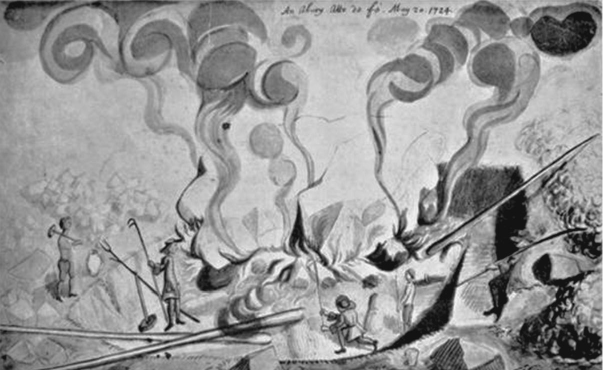
William Stukeley’s drawing of an atto da fe. Bodleian Library, Oxford, MS Gough Maps 231, fol. 5.

Tuesday, 14 October 2025

Castilly Henge Update

 Since my visit and post about the excavations at Castilly Henge the dig has been concluded and the results and finds are being analysed. 

The dating results of the henge bank and ditch have not been revealed yet but the key question whether there is evidence of the remains of a now-removed stone circle at the centre of the henge has some answers.


Dr Olaf Bayer, Historic England’s Senior Archaeological Investigator and Nicola Hembrey, Historic England Archaeological Excavation Principal at the Castilly Henge excavation. © Historic England. Image reference DP572335. Click to enlarge

The geophysical anomalies that hint a partial circle of features are real, the arc of three of them can be seen in the photo as dark features.

Sadly they aren't buried monoliths ready to be re-erected.

But they are rubble filled pits with a slope.

Intriguing, did they hold stones?

Correcting the Record on Cunnington's Rock Samples and Slides

Ah, the latest dispatch from the front lines of Stonehenge petrology: Robert Ixer's and Richard Bevins's catalogue of William Cunnington's Victorian-era thin sections and hand specimens, now gracing Academia.edu like a long-lost gem from Devizes. For those not in the weeds, this is a meticulous archive of 33 slides and their parent rocks from Cunnington's haul of 460 "foreign rock" fragments, scooped up between 1878 and 1881 from turf scrapes, wagon ruts, barrows, and even a few cheeky digs inside the circle itself. Sarsens? Wisely binned, as we're chasing the bluestones' secrets here. As inevitable as the Ancient Mariner waylaying yet another wedding guest with his watery woes, Brian John has slunk back to cast his jaundiced eye over the catalogue. John gets this bit spot-on in his review, bless him—it's a tidy summary of the collection's scope and its unbiased charm as a snapshot of surface debitage. Credit where due: he even flags the pyrite/marcasite oddity (unanalysed, alas) and the general lithological lineup, which does indeed mirror other collections in its "correct" proportions. One might almost think he's read the thing.

But then, inevitably, Brian John lurches into his familiar refrain, that weary old dirge about the "limited range of rock types" being a "tired old point" peddled by Ixer and Bevins to prop up their human-transport heresy. Oh, Brian—it's like watching a man clutch at straws in a gale, insisting the wind's just a myth because he hasn't dug up every sodden acre of Salisbury Plain. Yes, the catalogue quotes it proudly: all major groups (spotted dolerites, Rhyolite C, Andesite A, and the rest) tally up nicely, debunking the notion of "random glacial erratics" with a polite but firm wave of obsolete nomenclature. John concedes the proportions are "comparable," yet sneers that the duo have "over and again demonstrated... outliers and exceptions" in their own work, proving "multiple provenances." How deliciously selective! Those "outliers"—like the rare Dacite Group D in S57, now elevated to genuine bluestone status via Aubrey Hole finds, or the Greensand in S61—are precisely what the catalogue folds in with scholarly grace, not the chaotic scatter John dreams of for his ice-age fantasy. And his parting shot? That 50% of the monument's turf remains unexcavated, rendering all claims "very unwise"? Pure vapour—hand-wringing from a chap whose glacial hobbyhorse has been lamed by a generation of sediment cores, till fabrics, and isotopic dead-ends. It's not unwise; it's science, Brian. Do try keeping up.

Take the seven rhyolitic tuffs, all neatly slotted into Rhyolite Group C from Craig Rhos-y-felin, complete with their Jovian, Snowflake, and Zebra textures. John, ever the contrarian, brands this "wishful thinking rather than science," scoffing that Harrison et al. (1979) saw a "range" the authors blithely ignore. "No way that this claim can be accepted," he thunders. How droll—like a flat-Earther mocking satellite photos because they don't show the ice wall. The catalogue doesn't ignore Harrison; it updates him, with tight petrography (titanite clusters, chlorite infills, the lot) tying every variant back to Rhos-y-felin's outcrop. John's "pretence" jibe? That's the projection talking, a last gasp from a theory as threadbare as his patience for peer review. Fair play, though: he does nod to the appendices' "useful photos" and full descriptions—small mercies in the bile.

Then there's Table 1, that paragon of evolutionary nomenclature, tracing Cunnington's "Diabase" through Teall's ophitic musings to modern precision. John spies "clear evidence of 'forcing' lithologically different samples into predetermined groups," with some appendices showing "reasonable 'fits'" and others... well, not so much. Evidence? One might ask for a microscope, but no—it's all in the eye of the glacial beholder. Borderline calls like S74 ("volcanic with sub-planar texture," covering "a multitude of sins") or S57's anomalous Dacite D get flagged transparently as "ODD" or provisional, with calls for re-sectioning in the "Further Work" bit. No forcing here, just rigour; John's conspiracy of categories crumbles under its own weight. He scores a point on S52's heft (over 74g, cobble or chip?), rightly noting the orthostat ambiguity the authors "traditionally ignore." Touché—though the catalogue matches slides to specimens with forensic care, including fresh orthostat firsts like Stones 32c and 61a. Progress, Brian; it's unbecoming to sulk.

The Lower Palaeozoic sandstones fare better in his crosshairs: S1's hefty lump (500g, five pieces) from Barrow 41 (or 42—labelling's a muddle, as admitted), a mile off, and S69's broad-brush tag encompassing "many thousands of different lithologies." Spot-on reportage, and a reminder of these as the heavy hitters among non-dolerites (cf. that 8.5kg Roman shaft beast). But John's "S74... multitude of sins" and Greensand "inconvenien[ces]"? Derisory twaddle—these are the very anomalies that enrich the tale, not torpedo it, with S61's glauconite and foraminifera screaming local Cretaceous, not Welsh wanderlust.

And lo, the Altar Stone in Appendix 6—S45's dusky yellow, carbonate-cemented glory, with its limonite stains, stylolites, and that tantalising garnet in the heavy minerals. John quotes the microscopical description verbatim (muscovite laths, twinned plagioclase, the works), and even flags the "garnet problem" and Wilts 277's murky slide origins via his blogs. Hats off: this is John at his best, distilling the specialist stuff without the snark, nodding to the Scottish provenance buzz (Clarke et al., 2024) and prior harmonies (Ixer & Turner, 2006, et al.). It's a crumb he earns, linking micaceous debitage to Cunnington's own hunch.

In the end, John's review is a curate's egg: the shell's cracked with envy, but the yolk—those factual nuggets—nourishes. Yet it's vinegar strokes all the way down, a lonely obsession flogging a discredited glacial nag long after the field's moved on to quarries and causeways. Ixer and Bevins don't "fail to see the obvious"—they chase it with data, not daydreams. Multiple provenances? Aye, but sacred Welsh ones, not a slurry of ice-rafted odds and sods. The exceptions scream intentional transport, not random dump; John's "obvious conclusion" is the mirage he mistakes for an oasis. Welcome addition indeed—this catalogue polishes another facet of Stonehenge's human story, outliers and all. Brian, old chap, time to thaw that theory out for good.

Saturday, 11 October 2025

Charity Run from Preseli to Stonehenge


https://www.justgiving.com/page/alex-bance-10 


A Salisbury runner is retracing the journey of Stonehenge’s stones in a 300-mile charity challenge for Julia’s House Children’s Hospice.
Alex Bance, 45, set off from the Preseli Hills in west Wales, where the monument’s bluestones were quarried. Along the route — which passes via West Woods near Marlborough, the source of the sarsen stones — he plans to gather small stones from key locations and carry them to the ancient site. Bance will take brief 20-minute naps during the run and has already raised more than £1,800 to support the Wiltshire and Dorset hospice.


Tracker - https://track.trail.live/event/path-of-the-past

Social Media - http://www.facebook.com/spireinjuryclinic

http://instagram.com/spireinjuryclinic


Wednesday, 8 October 2025

Stonehenge and Avebury Setting Study - Approved by Cabinet

Wiltshire Council's Cabinet approves plan to help mitigate the potential impact of development on Stonehenge and Avebury World Heritage Site

Wiltshire Council's Cabinet has approved a Setting Study for the Stonehenge and Avebury World Heritage Site (WHS) which, if adopted by Full Council later this month (October), will be used to ensure that developments in Wiltshire do not adversely impact the internationally significant monuments and the area they are located in.

Stonehenge and Avebury WHS Setting Study SPD - Draft for adoption

Supporting documents:

Decision:

Resolved:


That Cabinet:


1.    notes the response to the consultation on the draft WHS Setting Study Supplementary Planning Document (the Setting Study) set out in the Consultation Statement at Appendix 1.


2.    endorses the amended Setting Study as set out in Appendix 2.


That Cabinet recommends that Council:


3.    Adopts the Setting Study (Appendix 2) to Council as a supplementary planning document at its meeting on 21 October 2025.


4.    Delegates to the Corporate Director, Place, in consultation with the Cabinet Member for Strategic Planning, Development Management and Housing, the authority to undertake the final stages associated with the formal adoption and publication of the Setting Study, including any minor textual changes in the interests of clarity and accuracy.


---------------------------------------------------------------------------------------------------------------------------


A summary of the Consultation concerns and responses:


Statutory/Advisory Bodies

Historic England

Concern: The draft SPD is thorough and robust, but suggested minor enhancements for effectiveness.
Council's Response: Incorporated technical comments via minor text amendments.

UNESCO World Heritage Centre/ICOMOS

Concern: Positive review overall, but suggested technical amendments and additions to strengthen the document, including references to key UNESCO documentation.
Council's Response: Added minor amendments where possible, such as further UNESCO references to bolster international obligations.

Natural England

Concern: Satisfied with ecological and historic environment information; no further issues.
Council's Response: None required.

National Highways

Concern: No particular comments; noted SPD contents and assessment requirements.
Council's Response: None required.

Local Interest Groups

Druid Groups

Concern: SPD should acknowledge contemporary spiritual/ceremonial value, human rights protections, experiential setting, and recommit to direct consultation with spiritual communities on planning applications.
Council's Response: Added reference to WHS Equal Opportunities Statement; definition of setting includes experiential aspects per national policy and Historic England guidance; all planning applications open to public comment.

CPRE South Wilts

Concern: Needs more numbering; greater weight on high visitor numbers' effects; undue emphasis on A303, requiring balanced view.
Council's Response: Added sub-section numbering; visitor infrastructure treated as development; roads in Stonehenge/Avebury addressed balancedly; future schemes assessed via SPD without altering decision criteria.

Cycling Opportunities Group for Salisbury

Concern: Omission of highways/Rights of Way works from HIA-required developments; prioritise reducing vehicular usage/impact.
Council's Response: Clarified HIA need for other development forms; sustainable transport for WHS Management Plan review.

Avebury Society

Concern: Supports Chapter 4 proposals; recommends cumulative impact control mechanism, including baseline study and triennial/biennial reviews.
Council's Response: Added clarification on cumulative impacts in Stage 4; monitoring for WHS Management Plan review.

Wiltshire Archaeological & NH Society

Concern: Supports OUV protection aim; balance archaeological protection with public access/research; mandate additional HIA elements for access, excavations, and community consultation.
Council's Response: Several elements outside SPD scope, already in planning process, or case-by-case; public access etc. for WHS Management Plan review.

Stonehenge Alliance

Concern: Detailed comments on setting nature, monument-landscape relationship, WHS boundary, buffer zone need, and A303.
Council's Response: Useful amendments for clarification (e.g., expanded Table 8 on HIA for major road schemes); some beyond SPD scope or for WHS Management Plan.

Town and Parish Councils

Amesbury Town Council

Concern: Greater explanation under 'need for screening' to help applicants understand development location.
Council's Response: Adjusted scoping description for clarity.

Marlborough Town Council

Concern: Supports proposals to secure/protect WHS.
Council's Response: None required.

Preshute Parish Council

Concern: Well-produced document, but significant Avebury-east monuments not in WHS.
Council's Response: Addresses existing WHS boundary (UNESCO consent needed for change); references external sites/elements with WHS relationships.

Developers/Consultants

General (two developers/planning consultants)

Concern: Welcomed clarity/certainty; but need term clarification, reduced complexity/readability; lack of balance on in/outside WHS settings, landscape vs. monuments; cumulative change and astronomical alignments concerns.
Council's Response: Amendments for ambiguity/consistency (e.g., glossary additions, section numbers); approach agreed with Historic England/UNESCO, so not all changes possible.

Members of the Public

General (varied comments)

Concerns: Document length/complexity/formatting; need applicant clarity; A303 addressing; inclusion of wider values/time periods, external monuments, buffer/boundary review; HIA/decision-making; geographic precision/terminology.
Council's Response: Reflects WHS international obligations requiring detailed information; HIA well-defined for OUV, SPD informs but does not change decision criteria (includes social/economic/environmental factors); A303 balanced; existing boundary focus (UNESCO limits); OUV landscape-centric, wider values not appropriate.

Farmers/Landowners

General

Concern: Lacks rural economy/local community recognition; extensive requirements prevent change without applicant needs balance.
Council's Response: SPD does not change decision criteria; added wording to reflect planning balance; decision-makers consider social/economic/environmental factors.

Overall Summary

  • Consultation responses welcomed; amendments enhanced clarity/precision without altering substance.
  • Key partners (e.g., National Trust, English Heritage) pre-consulted, no further input needed.
  • Final SPD strengthened for better planning assessments near WHS.

The Catalogue of the Wessex Museum Stonehenge Rock Thin Sections

William Cunnington Stonehenge rock thin sections - Catalogue

Rob Ixer and Richard Bevins

https://www.academia.edu/144337293/Cunningtons_Stonehenge_rocks_an_archive_of_the_thin_section_data


Salisbury Museum Accession Number 1983.20.47 - Patricia Cane

This catalogue, compiled by Rob Ixer and Richard Bevins in February 2025, documents 33 Victorian-era thin sections of Stonehenge rock fragments collected by William Cunnington between 1878 and 1881. These samples, primarily surface finds from within the Stonehenge circle and nearby excavations, represent an unbiased assortment of 'foreign rocks' (bluestones), excluding sarsens, and include the last known surface fragments from the monument's interior. The authors pair the thin sections—housed at the Wiltshire Museum—with corresponding hand specimens at the Salisbury Museum, providing macroscopic and microscopic petrographic descriptions. Historical identifications from researchers like Thomas Davies in Cunnington (1884), J.J.H. Teall (1894), and John Judd (1903), alongside later work by A.C. Harrison et al. (1979), are reconciled with modern nomenclature from Ixer and Bevins' ongoing studies (2010–2024). This reveals strong consistency in lithological groupings, such as spotted dolerites, rhyolitic tuffs from Craig Rhos-y-felin, and carbonate-bearing andesites, while debunking outdated names that have exaggerated the diversity of bluestone types to support glacial erratic theories. The collection's representativeness allows direct comparison with other Stonehenge debitage assemblages, affirming a restricted suite of Welsh-sourced volcanics and sandstones and the Scottish Altar Stone.

The detailed analyses in the appendices cover eight dolerites (including first petrographic descriptions of orthostats SH32 and SH61a), seven Rhyolite Group C tuffs, five Andesite Group A samples (with SH32c as type material), six Dacite Group B tuffs (type from SH38), one each of Dacite Group D, Altar Stone sandstone, and Greensand, plus three Lower Palaeozoic Sandstones. No novel rock types emerge, but the work highlights challenges like slide thickness and discolouration, which complicate observations. Appendices provide exhaustive microscopic descriptions, noting alterations (e.g., epidotisation, chloritisation) and key minerals (e.g., clinopyroxene, plagioclase, titanite). The authors advocate re-preparing polished thin sections for rarer lithologies and undescribed orthostats to enable advanced techniques like automated mineralogy.

Key Takeaways

  • Representativeness and Consistency: The Cunnington collection mirrors other bluestone debitage from the Stonehenge landscape, comprising a narrow range of lithologies (e.g., dolerites, rhyolites, andesites, sandstones), reinforcing human transport from Wales over glacial deposition models.
  • Nomenclature Updates: Modern reclassifications eliminate obsolete terms, clarifying that the bluestone suite is far less diverse than previously suggested, with most of the rhyolites tracing to Craig Rhos-y-felin and dacites distinguishing clearly in thin section.
  • New Insights on Orthostats: First-time petrographic data for stones SH32, SH32c (type for Andesite Group A), SH49, and SH61a, plus expanded recognition of Dacite Group B debitage from SH38, potentially indicating wider distribution.
  • Validation of Rare Groups: Confirms Dacite Group D as a legitimate bluestone lithology, based on this and prior finds, challenging its prior dismissal as non-monumental.
  • Recommendations for Future Work: Re-sectioning key samples for polished slides is urged to support geochemical and mineralogical provenance studies.