Sunday, 24 April 2022
The Field Guide to the Glacial Erratics of Salisbury Plain - The Book.
The proof copies were sent out and well received by the expert reviewers:
"Pithy, well researched, exhaustive."
I'm not sure I can be bothered with the hassle of looking for a larger print run, the information is out there and does anyone care enough about erratics to buy a book?
"said it was the best Stonehenge book she has ever read …..told her everything she wanted to know about Stonehenge."

And the first review is in from someone who hasn't seen or read the book:
Saturday, 2 April 2022
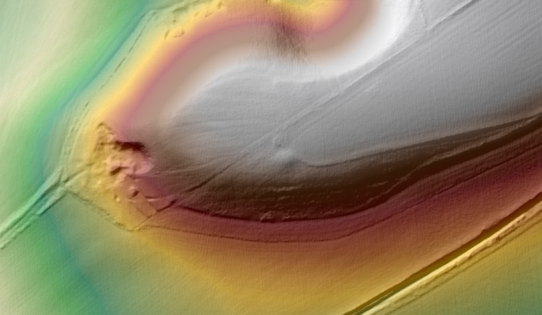
All Cannings Cross Round Barrow?
On the edge of the downland promontory above All Cannings Cross I think there is a round barrow. It wouldn't be unusual to find a barrow in such a position overlooking the vale. The Historic environment record only has an undated ring ditch in the same approximate position. https://services.wiltshire.gov.uk/HistoryEnvRecord/Home/ViewHERItem?HER=MWI8613
Is the ring what I think is the ditch around the barrow or is it the feature to the south of the mound on the Lidar - I couldn't find it on the ground.
There is a chance that the mound is from the digging of a dewpond to the north west of it. There isn't a pond there now but maybe just a hint there was an unmapped one? On balance I don't think so but I like to consider other possibilities.
Click photos to embiggen
Subscribe to:
Posts (Atom)


