Monday 21 December 2015

New Stonehenge Postholes Revealed

Excavations have been ongoing on the ridge to the south of the A303 near the Stonehenge Cottages to the east of Stonehenge and elsewhere where the proposed tunnel works may affect.

The Guardian has now made it public about the postholes that have been found:

http://www.theguardian.com/uk-news/2015/dec/21/stonehenge-tunnel-survey-reveals-new-sites-and-mysteries


Some 3,400 years before the roaring torrent of the A303 road sliced the Stonehenge landscape in half, some people cut a beautiful pit a metre deep into the chalk with no tools except picks made of red deer antlers.

They may have had primitive tools, but there was nothing primitive about their skills: the bottom of the pit was so neatly levelled that you could balance a beaker of mead on it without spilling a drop. 
As druids and tourists head towards Stonehenge for the winter solstice, which falls this year on 22 December, when the midwinter sun should set framed perfectly by the giant stones, Historic England archaeologists are hard at work teasing ancient secrets out of the landscape. 
The newly discovered pit was immaculately cut to hold a huge wooden post. A neat trench links to a second equally impressive pit for another massive post: in the rolling chalk downland, they would have been visible for miles. The line of the trench seems to lead on towards the neighbouring field full of curious Waitrose pigs, under a later bank but carefully jinking to avoid an earlier long barrow. 
But what is it? Phil McMahon, Historic England archaeologist, and his opposite number at the National Trust, Nick Snashall, laughed and shrugged. 
“A gateway? A boundary marker? A palisade? The truth is we just don’t know,” Snashall said. “We won’t even have a date [that it was created] until we get the lab results back.”

The Position of Stone Hole 97

English Heritage have marked the position of Stone Hole 97 with a very handsome marker.


Stone hole 97 was discovered by Mike Pitts in 1979 and is alongside the Heel Stone, it may be where a companion stone to the Heel Stone stood, or where the Heel Stone was moved from. The centre of it is abut 2m from the nearest point of the heel stone and is "cut through by the ditch around the Heelstone", with it mainly lying within the ditch enclosure.

Unfortunately the marker is about 5m from the Heel Stone and entirely without the ditch enclosure. If it marks where the second of a pair of stone stood the effect of two pillars bracketing the solstitial sunrise is now not obvious.

Before the marker was installed I wrote a bog post about getting the position correct. :( 


A quick photoshop of what a duplicate Heelstone would look like in Stonehole 97 (you will notice the marker to the right of "Stone 97"


ORIGINAL POST from May 2013


One of the improvements that is planned for Stonehenge is the marking of Stone Hole 97 and the Solstitial Alignment on the ground. But the plans seem to have 97 marked in the wrong place. 
UPDATE - EH say the mistake has been noted and will be corrected.


April 2012 EH plans for after the A344 is closed and grassed over from http://southplanning.wiltshire.gov.uk/public-planning-application-documents/00543000/00542853_Amended_Plan.pdf


Mike Pitts' plan at the same orientation taken from:


Mike Pitts' plan (and he discovered Stonehole 97) from http://mikepitts.wordpress.com/2012/12/01/stonehenge-in-five-easy-stages-or-perhaps-six/


A more detailed plan of the Heel Stone area, though I haven't located the original source.


Heelstone, Stonehenge - Refraction Seismic (1984) from http://www.panoramio.com/photo/58474363 by Gary Denke

Click any to embiggen


The Stonehenge New Visitor Centre prebuild opinions

Stonehenge visitor centre looks 'cheap and nasty'
11 September 2009 | By Elizabeth Hopkirk
http://www.bdonline.co.uk/

"...Paul Sample, a former mayor of Salisbury, has attacked the scheme as a “cheap and nasty” addition to the World Heritage Site; while Peter Alexander-Fitzgerald, a member of the International Council on Monuments & Sites, claimed the centre resembled “a derelict aircraft hangar”.


Sample said: “It’s cheap and nasty and isn’t going to do justice to the site. It looks like an immigration detention centre. It’s not something that makes you feel part of something ancient and mystic.

“We should be building something to last. We should have had an international competition.”

Alexander-Fitzgerald commented: “This looks like an IT student’s first attempt at rendered graphics. It’s amateurish and causes one to wonder about the quality of the finished product."

Sunday 20 December 2015

West Kennet Long Barrow Restoration

English Heritage have just finished a modest restoration of West Kennet Long Barrow - new drained floor, restored worn areas and replacement of the skylights with a more sympathetic arrangements of simple circular lightwells.

They seem to have done a very good job as my poor photos taken in the dusk of a murky day show.


Friday 18 December 2015

A Buried Sarsen at Durrington Walls

I was told that a sarsen stone had been spotted in a hole at Durrington Walls, and especially with the interest in the “Superhenge” idea of a row of buried stones under the bank there I thought a walk round was in order.


The reported stone is on the north side whereas the “Superhenge” row is on the other side, under the southern bank. And whereas they are believed to be large monoliths (or not stones at all in the competing hypothesis) this stone is quite small.


It is stuck fast in the ground but moves slightly on touch and I would estimate from the angle of movement it is about 60 cm in length at most. It is dark reddish colour, rounded and unworked as far as can be seen and is typical of the smaller local sarsens.

I have indicated its position with a circle on the photo and plan.


This area of the scarp seems quite free of modern debris but because of badger and rabbit damage the stone could easily have been deposited there at any time and then buried. It is the sort of stone a ploughman would have carried to the edge of a field and tipped onto the waste ground of the scarp.

(The bank of the henge is badly ploughed out on the flatter surface above the scarp.)

Further to the west there is a disputed entrance to the henge at the head of the valley up though the monument. As you walk round the scarp to this area the scarp becomes increasingly contaminated with what looks like early 20th Century rubbish, bottles, ash, some metal etc. Where the entrance might be there is a War Department concrete marker, marked with an arrow. It is obvious that this area was used as a rubbish dump and the shape of the scarp is altered by the accumulation of the rubbish. At the top of the entrance there seems to be a shallow hollow way towards Larkhill though the ground is very disturbed with animal holes and other field marks.


It would be great if the original features could be recovered from under the rubbish.

Monday 14 December 2015

"Rhosyfelin - Not A Quarry" Press Release

"Earth scientists who have worked at a "bluestone monolith quarry" site at Craig Rhosyfelin in Pembrokeshire have suggested that the archaeologists have got it all wrong, and that the so-called "engineering features" on the flank of the crag are entirely natural. Further, it is suggested that members of the digging team have unconsciously created the very features that they have cited in support of their quarrying hypothesis.

In a peer-reviewed paper published on 14th December 2015 in the peer-reviewed journal "Archaeology in Wales" journal Dr Brian John, Dr Dyfed Elis-Gruffydd and John Downes have described a set of Ice Age deposits and landforms at the site of an archaeological dig that was started in 2011, and have determined that there are no traces of human intervention in any of the features that have made the archaeologists so excited.... "


This research can be freely downloaded from Researchgate, and is also available from the journal office in hard copy.

JOHN, B.S., ELIS-GRUFFYDD, D. & DOWNES, J. (2015b). Observations on the supposed ‘Neolithic Bluestone Quarry’ at Craig Rhosyfelin, Pembrokeshire. Archaeology in Wales 54, pp 139-148.

https://www.researchgate.net/publication/286775899_OBSERVATIONS_ON_THE_SUPPOSED_NEOLITHIC_BLUESTONE_QUARRY_AT_CRAIG_RHOSYFELIN_PEMBROKESHIRE

Friday 11 December 2015

Reused Stones at Stonehenge

Mike Parker Pearson talks about the possible reuse of the Bluestones at Stonehenge from another monument and how other neolithic monuments show this property : http://theconversation.com/stonehenge-isnt-the-only-prehistoric-monument-thats-been-moved-but-its-still-unique-51962

Another archaeologist, and I can't be sure who it wa, mused to me about whether Stone 56, the tallest sarsen stone at Stonehenge was a reused stone some time ago. The fact what is now the buried portion of the stone is as finely worked as the rest was a factor in his suspicions.

Monday 7 December 2015

Video Of Carrying Bluestones Through The Mountains

Or actually a similar weight of automobile in Nepal...


Vehicle arrived in Kathmandu Valley up the mountain passes from Bhimphedi on the back of porters. There was no motorable road into the valley and inside it there were just a few kilometers of road wide enough for driving up and down Kathmandu and Patan. The Rana rulers of Nepal started importing vehicles for their own use and for the use of the King. The first car was imported during the time of Chandra Shumsher at the turn of the last century. The Mercedes Benz gifted by Adolf Hitler to Maharajah Juddha Shumsher in 1939 A.D., part of a diplomatic overture to influence Nepal to stay out of WWII, was also carried in this manner to Kathmandu.

Stonehenge quarries found 140 miles away in Wales - Full Press Release

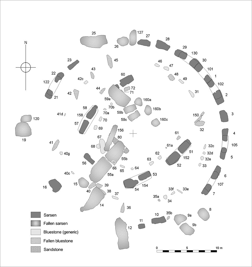
A team of archaeologists and geologists working in Wales have found two of the quarries that provided stones for Stonehenge. The very large standing stones at Stonehenge are of ‘sarsen’, a local sandstone, but the smaller ones - known as ‘bluestones’ - come from the Preseli hills in Pembrokeshire. Geologists have known since the 1920s that the bluestones were brought to Stonehenge from somewhere in the distant Preseli Hills, but only now has there been collaboration with archaeologists to locate and excavate the actual quarries from which they came.
“This has been a wonderful opportunity for geologists and archaeologists to work together” said Mike Parker Pearson, director of the project and professor of British later prehistory at University College London.  “The geologists have been able to lead us to the actual outcrops where Stonehenge’s stones were extracted.”
The Stonehenge bluestones are of volcanic and igneous rocks, the most common of which are called dolerite and rhyolite. Richard Bevins of the National Museum of Wales and Rob Ixer, honorary senior researcher at UCL and University of Leicester, have identified the outcrop of Carn Goedog as the main source of Stonehenge’s ‘spotted dolerite’ bluestones and the outcrop of Craig Rhos-y-felin as a source for one of the ‘rhyolite’ bluestones. Archaeological excavations at both sites have uncovered evidence of prehistoric quarrying.
The special formation of the rock, which forms natural pillars at these outcrops, allowed the prehistoric quarry-workers to detach each megalith (standing stone) with a minimum of effort. “They only had to insert wooden wedges into the cracks between the pillars and then let the Welsh rain do the rest by swelling the wood to ease each pillar off the rock face” said Dr Josh Pollard of the University of Southampton. “The quarry-workers then lowered the thin pillars onto platforms of earth and stone, a sort of ‘loading bay’ from where the huge stones could be dragged away along trackways leading out of each quarry.”
The team of scientists includes researchers from UCL, the universities of Manchester, Bournemouth and Southampton, the National Museum of Wales, and Dyfed Archaeological Trust. Professor Colin Richards of Manchester University, an expert in Neolithic quarries, said “The two outcrops are really impressive – they may well have had special significance for prehistoric people. When we saw them for the first time, we couldn’t believe our luck.”
Radiocarbon-dating of burnt hazelnuts and charcoal from the quarry-workers’ camp fires reveals that there were several occurrences of megalith-quarrying at these outcrops. Stonehenge was built during the Neolithic period, between 4,000 to 5,000 years ago. Both of the quarries in Preseli were exploited in the Neolithic, and Craig Rhos-y-felin was also quarried in the Bronze Age, around 4,000 years ago.
“We have dates of around 3400 BC for Craig Rhos-y-felin and 3200 BC for Carn Goedog, which is intriguing because the bluestones didn’t get put up at Stonehenge until around 2900 BC” said Parker Pearson. “It could have taken those Neolithic stone-draggers nearly 500 years to get them to Stonehenge, but that’s pretty improbable in my view.  It’s more likely that the stones were first used in a local monument, somewhere near the quarries, that was then dismantled and dragged off to Wiltshire.”
Professor Kate Welham of Bournemouth University thinks that the ruins of any dismantled monument are likely to lie somewhere between the two megalith quarries: “We’ve been conducting geophysical surveys, trial excavations and aerial photographic analysis throughout the area and we think we have the most likely spot. The results are very promising - we may find something big in 2016.”
The megalith quarries are on the north side of the Preseli hills, and this location undermines previous theories about how the bluestones were transported from Wales to Stonehenge.  Previous writers have often suggested that bluestones were taken southwards from the hills to Milford Haven and then floated on boats or rafts, but this now seems unlikely. “The only logical direction for the bluestones to go was to the north then either by sea around St David’s Head or eastwards overland through the valleys along the route that is now the A40” said Parker Pearson. “Personally I think that the overland route is more likely. Each of the 80 monoliths weighed less than 2 tons, so teams of people or oxen could have managed this. We know from examples in India and elsewhere in Asia that single stones this size can even be carried on wooden lattices by groups of 60 – they didn’t even have to drag them if they didn’t want to.”
Phil Bennett, archaeologist for the Pembrokeshire Coast National Park, said: “This project is making a wonderful contribution to our knowledge of the region’s importance in prehistory.” The new discoveries may also help to understand why Stonehenge was built. Parker Pearson and his team believe that the bluestones were erected at Stonehenge around 2900 BC, long before the giant sarsens were put up around 2500 BC. “Stonehenge was a Welsh monument from its very beginning. If we can find the original monument in Wales from which it was built, we will finally be able to solve the mystery of why Stonehenge was built and why some of its stones were brought so far”.
The project’s results are published this month in the journal Antiquity and in the January issues of British Archaeology and Current Archaeology.  It also features in a new book published this month by the Council for British Archaeology, Stonehenge: making sense of a prehistoric mystery. Further excavations are planned for 2016.

The project is led by Prof. Mike Parker Pearson (UCL), Dr. Richard Bevins (National Museum of Wales), Dr. Rob Ixer (UCL and University of Leicester), Dr. Josh Pollard (University of Southampton), Prof. Colin Richards (University of Manchester), Mr. Duncan Schlee (Dyfed Archaeological Trust) and Prof. Kate Welham (Bournemouth University). It has been funded by the National Geographic Society, the Society of Antiquaries of London, the Royal Archaeological Institute, the National Museum of Wales and the Cambrian Archaeological Association, with support from the Pembrokeshire Coast National Park.

Thursday 3 December 2015

Looking into Postholes


I have a belief that many postholes held inverted trees - just a belief, no evidence - so I was interested to see the posthole Josh Pollard et al excavated on the West Kennet Avenue near to Avebury which was in a tree throw hollow and maybe was that tree being resurrected, maybe upside down.

This is just a few brief notes I have made on other posthole shapes for my further rumination.


Seahenge 

2049BCE

" Inverting the central tree" 

“ It is probable that the central pit was excavated first, and the great inverted tree was drawn into place with the aid of the ropes. The alternative is to suggest that the central tree was transported over the construction trench for the timbers, which seems unlikely. It is likely that the excavation of the 1.50 m deep pit would have penetrated below the water table, and would have required bailing. The authors can state from experience that this would have been a particularly difficult and dirty task. The central tree was drawn to the edge of the pit and then reharnessed around its girth to provide leverage for the inversion. After the tree was pushed and pulled into place the ropes were not retrievable, and remained in the tow-holes. The knot used for the inversion was left wedged in the side of the pit …
…The sides of the hole had been moulded to the size and shape of the lower part of the tree and despite excavation into the sides and base of the feature no additional fill was identified.” (1)

So a vertical pit without a ramp for an inverted tree:


Durrington Walls 

 ~ 2600BCE
Postholes, many with ramps.
 (2)


West Kennet Avenue  -

c.3400–2900 BC

One deep posthole found in 2015 within a tree throw hollow – no ramp (but complete hole not excavated.)
 (3)


Stonehenge Mesolithic Postholes

The new posthole markers (tree throw marker to fore).


No ramps and a tree throw.

Pine charcoal in pit A HAR-455 dates 8800-7790BC.
Pine charcoal in pit B HAR-456 dates 7490-6640BC.


(4)
 (5)

Spot marked D is an unreported disturbance spotted in a trench during the restoration of the carpark to grassland.


Click any picture to embiggen.


1: The Survey and Excavation of a Bronze Age Timber Circle at Holme-next-the-Sea, Norfolk, 1998–9. Mark Brennand, Maisie Taylor, Trevor Ashwin, Alex Bayliss, Matt Canti, Andrew Chamberlain, C.A.I. French, Val Fryer, Rowena Gale, F.M.L. Green, Cathy Groves, Allan Hall, Neil Linford, Peter Murphy, Mark Robinson, James Wells and David Williams Proceedings of the Prehistoric Society / Volume 69 / January 2003, pp 1 - 84 DOI: 10.1017/S0079497X00001250, Published online: 18 February 2014 http://journals.cambridge.org/abstract_S0079497X00001250


2: Wainwright, G J, and Longworth, I H, 1971, Durrington Walls excavations, 1966-1968 (Reports of the Research Committee of the Society of Antiquaries of London 29). London: Society of Antiquaries


3: Living on the Avenue: investigating settlement histories and other events at West Kennet, near Avebury : Mark Gillings, Mike Allen, Charly French, Rosamund Cleal, Nick Snashall, Alistair Pike & Joshua Pollard http://www.prehistoricsociety.org/files/PAST_81_for_web.pdf


4: Cleal, R. M. J., Walker, K. E. and Montague, R., 1995, Stonehenge in its landscape: Twentieth century excavations English Heritage Archaeological Report 10


5: Google maps annotated by T C Daw

Wednesday 2 December 2015

Welcome to Rybury

With a great nephew having recently arrived and been given the splendid middle name of Rybury I was prompted to search out the report on Rybury and its causewayed enclosure. It is overlain by the much more prominent Iron Age hill fort but because it is tilted off the crown of the hill it is still mostly visible. The Iron Age folk being more concerned with building a defensive position ringed the crown of the hill.


Th detailed report on the causewayed enclose is at http://archaeologydataservice.ac.uk/archiveDS/archiveDownload?t=arch-1416-1/dissemination/pdf/9781848021877_ALL.pdf

Britain from Above has some 1947 photos of the area as well:

Rybury Camp, All Cannings, 1947 - Britain from Above

Wednesday 25 November 2015

Winter Solstice at Stonehenge December 22 2015


The celebration of the Winter Solstice at Stonehenge will take place at sunrise on Tuesday 22nd December 2015 (approximately 08:09 hrs).

English Heritage is offering ‘Managed Open Access’ for those who wish to celebrate the Winter Solstice Sunrise.

Visitors will be allowed into the Monument when it is considered sufficiently light to ensure safe access. Entry will be available from approximately 07:30 hrs until 09:00 hrs when visitors will be asked to vacate the site.

Access might not be possible if the ground conditions are poor or if it is felt that access might result in severe damage to the Monument.

Public Transport is being provided by Salisbury Reds buses and will be running from 06:00 from Salisbury.

Parking is very limited. You will have to walk in the dark on uneven surfaces so be dressed and shod appropriately and bring a torch.

Many people will park on the Byway adjacent to the Monument field that runs from the A303 to Larkhill. The turn on to it and off it from the A303 is hazardous. DO NOT turn right either into it or out of it, Carry onto the next roundabout and turn there.

A limited number of permits will be available for blue badge disabled parking at the New Visitor Centre and there will be dedicated accessible transport to the stone circle - which will begin just prior to the opening of the monument field. Please apply to Sandra.Ross@english-heritage.org.uk


EH Conditions of Entry


Connected:

My paper on how the Great Trilithon aligns to the Winter Solstice Sunrise

Tuesday 24 November 2015

How Many Stones or Rocks Does Stonehenge Have?

There are 93 rocks or lumps of stone visible at Stonehenge now - not counting the buried and missing ones. All the stones are numbered on standard plans, see below.

Note, if a numbered stone is broken and two separate bits or fragments of it are visible then it counts as two stones etc.

I have checked this on the ground, but errors may remain, please comment if you spot any.

Stone No. Volume (m³) Estimated above ground weight (tonnes)Additional visible fragments
15.4513.08
28.0319.27
35.5513.32
46.6615.98
55.6413.53
65.5413.29
75.9714.32
8*0.651.56
9a/b0.250.291
107.0716.96
11†2.034.87
12‡6.3215.16
14‡2.916.98
15*1.313.14
169.823.52
19*1.653.96
214.6111.06
225.4713.128
234.9211.8
25*2.957.08
26*0.40.96
275.2112.48
289.0821.792
296.9516.68
307.7518.6
519.8623.66
5211.5427.69
537.5618.14
5412.2229.32
55a/b6.615.841
569.6123.06
5711.6427.93
5810.0224.04
59a/b/c*9.121.842
609.0121.62
911.162.78
930.561.34
95‡1.754.2
9612.4729.92
1011.884.51
1022.76.48
1051.593.81
1072.15.04
120*0.491.17
1222.76.48
127*0.61.44
1302.66.24
1524.8911.73
1547.2917.49
1563.78.88
1586.916.56
160*2.095.012
310.682.04
32‡0.381.14
330.170.51
340.110.33
35a‡0.00070.002
35b‡0.0030.01
36‡0.090.27
370.270.81
38
39‡0.160.48
40
41‡0.240.72
42‡0.10.3
43
44
45‡0.140.42
46†0.140.34
470.421.26
48‡†0.0660.16
490.371.11
610.320.961
620.411.23
630.41.2
64
65
66

67‡0.531.59
680.712.13
690.722.16
700.411.23
72*0.511.53
80 Altar Stone1
150
Totals:
85680.9628
Total Visible Stones 93


Stone 40g is not counted because all that is visible is a lead cap.

How many stones did Stonehenge originally have is a different question.

There are five Sarsen Trilithons which gives fifteen large Sarsen stones.
The outer ring of Sarsens is planned to contain thirty uprights and thirty lintels so that is 75 worked sarsens in total.
There are four sarsens outside the centre, the two Station Stones, the Slaughter Stone and the Heel Stone.
There are stoneholes for other stones matching these, another two station stones, a matching Slaughter Stone and a paired hole to the Heel Stone. (There are other holes such as the F,G and H holes which maybe were stoneholes.) These empty holes may have held other stones or maybe stones that were then moved, for instance the Heel Stone may have originally occupied Stonehole 97. So that is between five and ten other sarsens.

There is the Altar Stone, origin unknown.

And lots of bluestones and bluestone holes. There are 29 bluestones that are still visible, but the original number is probably around 80. They have been shuffled around the holes so it is hard to be sure but that is a reasonable estimate.

So Stonehenge may have had up to 165 stones originally. It also had a vast number of stone fragments and hammerstones used for packing.

Where are the missing stones from Stonehenge?
We don't know.
There is broken up bluestone, known as debitage, all over the site. Is this from stones being broken up for tools and talismen or is it the remains of shaping the stones?
We know bits have been knocked off the edges of stones, greatly reducing them in some cases but complete stones carted off for use elsewhere have not been found despite searches. So it is another Stonehenge mystery.

(Note this is an updated post combining previous published posts into one.)

April 2020 - Note from http://www.stonesofstonehenge.org.uk/p/missing-stones.html

Some bluestones and bluestone fragments that are labelled on the plan, for example Stones 32c (Type: Altered Volcanic Ash), 32d (Type: Spotted Dolerite), 32e (Type: Rhyolite), 33e (Type: Altered Volcanic Ash), 33f (Type: Altered Volcanic Ash), 40c (Type: Calcareous Ash), 41d (Type: Altered Volcanic Ash), 42c (Type: Sandstone with Mica), 70a (Type: Spotted Dolerite), 70b (Type: Unknown) and 71 (Type: Unknown),.... are not visible above ground level and exist only as completely buried stumps.