Saturday, 31 January 2026

Advances in Stonehenge Research: A Review of Key Publications from 2025 and Early 2026

Abstract

Stonehenge, the iconic Neolithic monument on Salisbury Plain, continues to captivate archaeologists through innovative analytical techniques and interdisciplinary approaches. This review synthesises major publications from 2025 and early 2026, focusing on themes of stone sourcing, transport logistics, landscape archaeology, palaeoenvironmental reconstructions, astronomical alignments, and non-invasive methods for detecting hidden features. Key findings reinforce human agency in the monument's construction, highlighting extensive prehistoric networks, ritual complexities, and environmental interactions. Debates on sarsen provenances and glacial theories persist, while advancements in digital modelling address challenges like lichen obscuration. Collectively, these studies enhance our understanding of Stonehenge's role within broader Neolithic and Bronze Age societies.

Introduction

Stonehenge's enduring mystery has spurred a surge in research, particularly in 2025, leveraging advanced technologies such as isotope analysis, geophysical surveys, and machine learning. This article consolidates insights from recent peer-reviewed papers, emphasising deliberate human efforts in stone procurement and placement, while dispelling naturalistic explanations like glacial transport. Sections are organised thematically: bluestone and sarsen sourcing, faunal evidence, landscape features, palaeoenvironmental contexts, astronomical observations, and methodological innovations for carvings. The review draws on publications up to January 2026, reflecting the dynamic pace of discoveries.

Bluestone Sourcing and Transport: Rejecting Glacial Hypotheses

A cornerstone of 2025 research was the re-examination of bluestone origins, firmly attributing their presence at Stonehenge to Neolithic human endeavour rather than Pleistocene ice sheets. A pivotal study analysed the 'Newall boulder', a rhyolite fragment excavated in 1924. Using X-ray, geochemical, microscopic, and surface textural analyses, researchers concluded that the boulder exhibits no glacial erosion signatures, such as striations or polishing. Published in the Journal of Archaeological Science: Reports in July 2025, this work provides comprehensive petrological data, supporting intentional transport from Pembrokeshire, Wales, over 200 kilometres.

Complementing this, an early 2026 publication in Communications Earth & Environment employed mineral fingerprinting of over 500 zircon and apatite grains from local river sediments. Led by Curtin University's Anthony J. I. Clarke, the analysis revealed no northern or western mineral signatures indicative of glacial deposition, confirming human movement of bluestones from Wales and potentially Scotland. These findings challenge lingering glacial erratic theories and underscore prehistoric logistical prowess.

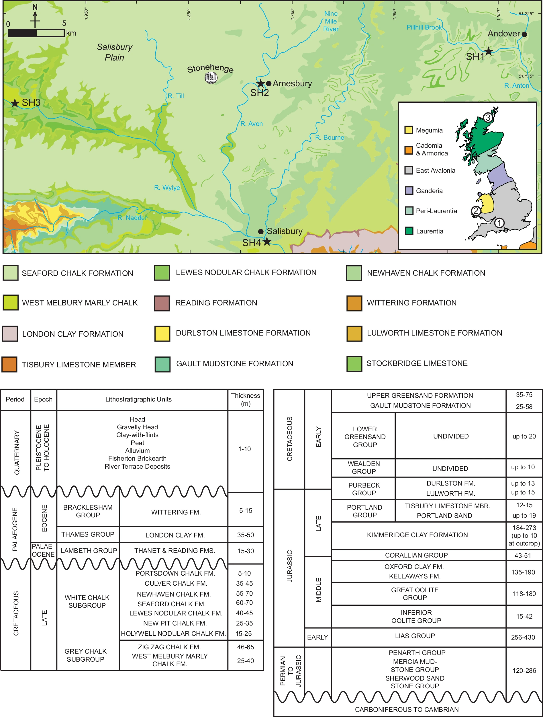
Sarsen Sourcing Debates: Geochemical Controversies

Sarsen stones, the massive sandstone uprights and lintels, have been a focal point of provenance studies. A scholarly exchange in Archaeometry highlighted methodological disagreements. In 2024, Anthony Hancock et al. reanalysed data from Nash et al.'s 2020 study, which identified West Woods in Wiltshire as the primary source. Hancock's team critiqued zirconium-normalised trace elements, favouring absolute concentrations and ratios, and proposed alternative origins for stone #58, such as Clatford Bottom or Piggledene, even suggesting possible glacial transport from Scandinavia.

Nash and T. Jake R. Ciborowski responded in 2025, defending their approach by noting Hancock's reliance on weathering-susceptible mobile elements and inadequate handling of intra-site variability. They reaffirmed West Woods using multi-sample statistics, dismissing glacial ideas as geologically implausible. Hancock's subsequent reply upheld their methods, maintaining possibilities of diverse sources. This unresolved debate illustrates the complexities of geochemical sourcing in archaeology.

Relatedly, a January 2025 study in Proceedings of the Prehistoric Society examined the Cuckoo Stone and Tor Stone, recumbent sarsens on the River Avon's banks. Portable X-ray fluorescence confirmed origins in West Woods, 20-25 kilometres north, with deliberate placement around 2940–2750 cal BCE, predating Stonehenge's main sarsen phase. Their intervisibility suggests a ceremonial 'portal', integrating Orcadian influences.

Faunal Evidence: Networks and Logistics

Isotopic analyses of animal remains illuminated prehistoric mobility. An August 2025 paper in the Journal of Archaeological Science studied a Neolithic cow tooth from Stonehenge's south entrance. Sequential strontium and lead sampling indicated Welsh origins, aligning with the monument's construction circa 2995–2900 BCE. This supports oxen from western Britain hauling bluestones, evidencing vast networks.

Extending to the Bronze Age, a September 2025 study in Nature Ecology & Evolution analysed isotopes from animal bones in Wiltshire and Thames Valley middens (c. 1000–800 BCE). Pigs dominated, originating from Scotland, Ireland, and Wales, implying long-distance travel for feasts, while cattle and sheep were local. Stonehenge's landscape thus served as a communal hub.

Landscape Archaeology: Pits, Boundaries, and Palaeoenvironments

Geophysical surveys revealed expansive features. A November 2025 article in Internet Archaeology detailed Neolithic pits encircling Durrington Walls, 3 kilometres from Stonehenge. The Stonehenge Hidden Landscapes Project used magnetometry, ground-penetrating radar, and coring to confirm 16 man-made pits forming arcs, dated to the Late Neolithic via chemostratigraphy and ancient DNA. These suggest a massive ceremonial boundary, the largest in Britain.

Palaeoenvironmental work in the Preseli Hills, published October 2025 in Environmental Archaeology, used pollen cores to depict a wooded Mesolithic-Neolithic landscape with gradual pastoral shifts. Cereal pollen from 3000–2200 BCE indicates sustained occupation post-bluestone quarrying.

Astronomical Alignments: Lunar Perspectives

Bournemouth University's project documented the 2024–2025 Major Lunar Standstill, capturing moonrises relative to Station Stones. Observations suggest Neolithic incorporation of lunar cosmology, beyond solar alignments, with publications anticipated.

Methodological Innovations: Detecting Hidden Carvings

A 2025 paper in Journal of Archaeological Science: Reports (PII: S1296207425001487) employed Difference of Gaussians, pseudo-depth mapping, and MeshNet to identify Early Bronze Age axe-head carvings on Stone 53, discovering 4 new, 10 potential, and 9 reinterpreted ones with 90.7% accuracy.

Addressing lichen obscuration (covering 23% of surfaces), a July 2025 study in Results in Engineering developed lichen simulation and laser scan models to virtually remove Ramalina siliquosa, predicting hidden carvings non-invasively with 73.4% accuracy using adapted MeshNet. A related thesis integrated terahertz spectroscopy for lichen penetration, identifying optimal conditions.

Chronological Modelling

The 2024 Historic England report by Marshall et al. presents refined radiocarbon age models for Woodhenge at Durrington, Wiltshire, utilising Bayesian sequence modelling to date the timber monument's construction to 2635–2575 cal BC (95% probability), with the enclosing ditch and bank following in 2555–2505 cal BC (2% probability) or more likely 2495–2180 cal BC (93% probability), thereby clarifying its phased development and integration with nearby features such as Durrington Walls. Complementing this, Greaney et al.'s 2025 study in Antiquity refines the chronologies for the Flagstones circular enclosure and Alington Avenue long enclosure in Dorchester, Dorset, through 17 new radiocarbon measurements and Bayesian analysis, establishing Flagstones' construction at 3315–3130 cal BC (95% probability) and Alington Avenue predating it by 110–470 years (95% probability), with these dates pre-dating traditional estimates for henge-like structures by up to 285 years and highlighting early innovations in circular monument forms that bridge Early and Middle Neolithic traditions. These revised timelines underscore evolving ceremonial practices and potential connections to broader European networks, prompting a reassessment of monument sequences across the region.

References

Bevins, R.E., Pearce, N.J.G., Ixer, R.A., Scourse, J., Daw, T., Parker Pearson, M., Pitts, M., Field, D., Pirrie, D., Saunders, I. & Power, M.R., 2025. The enigmatic ‘Newall boulder’ excavated at Stonehenge in 1924: new data and correcting the record. Journal of Archaeological Science: Reports, 59, 105303. Available at: https://doi.org/10.1016/j.jasrep.2025.105303

Clarke, A.J.I., Kirkland, C.L., Bevins, R.E. et al. A Scottish provenance for the Altar Stone of Stonehenge. Nature 632, 570–575 (2024).  Available at: https://doi.org/10.1038/s41586-024-07652-1

Clarke, A.J.I. & Kirkland, C.L., 2026. Detrital zircon–apatite fingerprinting challenges glacial transport of Stonehenge’s megaliths. Communications Earth & Environment, 7(1), pp.1–12. Available at: https://doi.org/10.1038/s43247-025-03105-3

Esposito, C. et al., 2025. Diverse feasting networks at the end of the Bronze Age in Britain (c. 900–500 BCE) evidenced by multi-isotope analysis. iScience, 28(10), 113271. Available at: https://doi.org/10.1016/j.isci.2025.113271

Evans, J.A. et al., 2025. Sequential multi-isotope sampling through a Bos taurus tooth from Stonehenge, to assess comparative sources and incorporation times of strontium and lead. Journal of Archaeological Science, 180, 106269. Available at: https://doi.org/10.1016/j.jas.2025.106269

Gaffney, V. et al., 2025. The perils of pits: Further research at Durrington Walls henge (2021–2025). Internet Archaeology, 69. Available at: https://doi.org/10.11141/ia.69.19

Greaney, S., Marshall, P., Hajdas, I., Dee, M., et al., 2025. Beginning of the circle? Revised chronologies for Flagstones and Alington Avenue, Dorchester, Dorset. Antiquity. Available at: https://doi.org/10.15184/aqy.2025.28

Hancock, A.J. et al., 2024. Stonehenge revisited: A geochemical approach to interpreting the geographical source of sarsen stone #58. Archaeometry, 67(2), pp.435–456. Available at: https://doi.org/10.1111/arcm.12999

Harding, P. et al., 2025. Earliest movement of sarsen into the Stonehenge landscape: New insights from geochemical and visibility analysis of the Cuckoo Stone and Tor Stone. Proceedings of the Prehistoric Society, 91, pp.1–25. Available at: http://dx.doi.org/10.1017/ppr.2024.1

Leong, G., Brolly, M. & Nash, D.J., 2025a. Novel approaches for enhanced visualisation and recognition of rock carvings at Stonehenge. Journal of Cultural Heritage, 75, pp.112–121. Available at 
SSRN: https://ssrn.com/abstract=5126093 or http://dx.doi.org/10.2139/ssrn.5126093

Leong, G., Brolly, M. & Nash, D.J., 2025b. Novel lichen simulation and laser scan modelling to reveal lichen-covered carvings at Stonehenge. Results in Engineering, 27, 106377. Available at: https://doi.org/10.1016/j.rineng.2025.106377

Marshall, P., Chadburn, A., Hajdas, I., Dee, M. & Pollard, J., 2024. Woodhenge, Durrington, Wiltshire: Radiocarbon dating and chronological modelling. Historic England Research Report Series 94/2024. Available at: https://historicengland.org.uk/research/results/reports/94-2024

Nash, D.J. & Ciborowski, T.J.R., 2025. Comment on: ‘Stonehenge revisited: A geochemical approach to interpreting the geographical source of sarsen stone #58’. Archaeometry, 67(3), pp.789–794. Available at: https://doi.org/10.1111/arcm.13105

Parker Pearson, M. et al., 2024. Stonehenge and its Altar Stone: The significance of distant stone sources. Archaeology International, 27(1), pp.113–137. Available at: https://doi.org/10.14324/AI.27.1.13

Silva, F., Chadburn, A. & Ellingson, E., 2024. Stonehenge may have aligned with the moon as well as the sun. The Conversation. Available at: https://theconversation.com/stonehenge-may-have-aligned-with-the-moon-as-well-as-the-sun-228133

Spencer, D.E. et al., 2025. Prehistoric landscape change around the sources of Stonehenge’s bluestones in Preseli, Wales. Environmental Archaeology. Advance online publication. Available at: https://doi.org/10.1080/14614103.2025.2574741

Thursday, 29 January 2026

William Stukeley's 1730 Bible

William Stukeley's 1730 Bible sold for £6500 today, a bit too rich for me;

"William Stukeley's annotated 1683 edition of the Holy Bible, inscribed by him in 1730 and replete with his marginalia, stands as a seminal artefact in the history of British antiquarianism and the intellectual evolution of ideas surrounding ancient monuments like Stonehenge, offering an unparalleled window into the mind of an 18th-century scholar who seamlessly blended biblical literalism with emerging archaeological speculation; this personal copy, bound in two volumes and featuring handwritten notes, sketches, and explicit references to "Stonehenge" alongside passages such as 1 Kings 18:31—where Elijah rebuilds an altar with twelve stones representing the tribes of Israel—illustrates Stukeley's burgeoning theory that such scriptural altars paralleled the Druidic stone circles he observed at sites like Avebury and Stonehenge, positing them as post-diluvian temples erected by oriental colonies (likely Phoenicians) who brought patriarchal religion to Britain shortly after Noah's Flood; predating his influential 1740 publication Stonehenge, A Temple Restor'd to the British Druids by a decade, these annotations reveal the formative stages of his deluvian framework, where he interpreted prehistoric structures as evidence of a pure, ancient faith inherited from biblical patriarchs like Abraham, thereby challenging classical notions of British origins and contributing to the Romantic revival of Druid mythology that influenced later figures such as William Blake; moreover, the marginalia, including a stone circle illustration in Exodus and notes linking "Romans" and "Britain" in the Book of Joel, underscore Stukeley's role as a pioneering field archaeologist and clergyman whose work bridged theology, geology (as seen in his flood-based interpretations of fossils), and history, making this Bible not merely a religious text but a foundational document in the development of prehistoric studies in Britain."


Description

Stukeley (William).- Bible, English. The Holy Bible Containing the old Testament and the New, 1 vol. bound in 2, each with same engraved general title (dates evidently altered from 1682), divisional title to NT dated 1673, folding engraved map at start vol. 1 (laid down and repaired with some loss, manuscript notes to verso), 2 folding maps tipped-in to NT, woodcut initials, lacking The whole book of Psalms at end, both titles with ownership inscription "W: Stukeley MD. 1730" to verso, that of vol. 1 also with "Stamford" beneath, annotated by Stukeley throughout, including a few marginal illustrations, vol. 1 map and first few leaves repaired at inner-margin and loose, vol. 1 title chipped at edges, vol. 1 2K4 & 3G2 small hole affecting couple letters, trimmed close at head, sometimes into headline, annotations occasionally shaved at fore-edge, occasional light damp-staining, some foxing and light browning, later panelled calf, spines chipped with loss and lacking labels, rubbed and worn, upper covers detached, [ESTC R469361], Cambridge, John Hayes, 1683; and a biography of Stukeley (1985), 4to & 8vo (3)

⁂ William Stukeley (1687-1765), antiquary and natural philosopher. A significant influence on the later development of archaeology, he pioneered the scholarly investigation of the prehistoric monuments of Stonehenge and Avebury in Wiltshire. In 1718, he was elected a Fellow of the Royal Society and became the first secretary of the Society of Antiquaries of London. This copy contains a small marginal illustration of a stone circle in Exodus (F8v), "And Moses built an altar". Stukeley also references "Stonehenge" in the Book of Kings (2F3v), and "Romans" and "Britain" at the opening of the Book of Joel (3N1).

Tuesday, 27 January 2026

Monday, 26 January 2026

Drawings of the Altar Stone Engraved Lines

In October 2024 I discovered photos of enigmatic engravings on the Stonehenge Altar Stone in the English Heritage archive - I have just created three drawings of them which are free to use with acknowledgment.

They remain a few inches below the surface waiting for further investigation. Richard Akinson uncovered them but no record of them was recorded - further detail can be found at https://www.sarsen.org/2025/02/the-archive-excavation-of-altar-stone_24.html


The photographs, labeled P50106 and P50107, partially show the excavated south side of the middle of the Altar Stone.

Sunday, 25 January 2026

Review: Mobility of Interred Individuals at Neolithic Tombs in Wales Using Sulfur (δ³⁴S) Bone Collagen Isotope Values and a Predictive Archaeological Sulfur Isoscape for the UK

Damon Tarrant, Richard Madgwick, Leïa Mion, Angela Lamb, Alasdair W. R. Whittle, Michael P. Richards; Mobility of interred individuals at Neolithic tombs in Wales using sulfur (δ34S) bone collagen isotope values and a predictive archaeological sulfur isoscape for the UK. R Soc Open Sci. 1 January 2026; 13 (1): 251696. https://doi.org/10.1098/rsos.251696

This paper by Tarrant et al. represents a very interesting and potentially groundbreaking contribution to Neolithic archaeology in Britain. It focuses on using sulfur isotope (δ³⁴S) analysis of bone collagen from 27 individuals buried in five early Neolithic tombs in south Wales (Heston Brake, Parc le Breos Cwm, Penywyrlod, Tinkinswood, and Ty Isaf) to infer mobility and dietary patterns during adulthood. By developing a novel predictive sulfur isoscape for the UK based on archaeological faunal data, the authors provide a framework for interpreting these values against regional baselines. While the study is preliminary and rightly cautious in its interpretations—acknowledging assumptions about baselines and the need for larger datasets—it lays a solid foundation for future research in isotope-based mobility studies.


(A) δ34S isoscape of the UK using faunal collagen. (B). δ34S faunal error isoscape of the UK. Circles represent site locations for the collagen sulfur data.

The methodology is innovative, employing random forest regression to create a high-resolution δ³⁴S isoscape from median values of 735 faunal collagen samples across 38 UK sites. This model incorporates environmental predictors like mean annual precipitation (a key driver, explaining ~60% of variation) and bedrock geology, achieving a respectable R² of 0.82 and a mean prediction error of ~4‰. Human δ³⁴S values (ranging from 11.2‰ to 17.7‰) are then compared to this isoscape using the R package 'AssignR' to assess 'local' versus 'non-local' origins. The approach complements earlier strontium isotope work on the same sites, which reflects childhood mobility, allowing for a more holistic view of life histories.

The results are intriguing and challenge some preconceptions about Neolithic lifeways in Wales. All individuals appear broadly local to Wales, aligning with genetic evidence of continental migration during the Neolithic transition. However, four of the five tombs include potential non-locals to their specific regions—for instance, some at Parc le Breos Cwm may originate from further east, while higher values at Ty Isaf and Penywyrlod suggest shifts between coastal and inland areas. Notably, despite the coastal settings of several sites such as Parc le Breos Cwm, there is no evidence for substantial marine dietary input or strong coastal sulfur enrichment (e.g., from sea-spray influence), reinforcing previous carbon and nitrogen isotope results that indicate predominantly terrestrial subsistence. This absence of marine influence is particularly fascinating, hinting at cultural or economic preferences in food procurement during the fourth millennium cal BC.

The study's caution is commendable, especially in comparing the archaeological collagen isoscape to a modern plant-based one, which reveals discrepancies potentially due to anthropogenic changes like pollution or landscape alterations affecting soil sulfur cycles. Linking sulfur (adult mobility) with strontium (childhood) opens avenues for exploring lifecycle movements, such as potential exogamy or resource exchange networks.

That said, reliance on data from midden sites (e.g., Potterne, All Cannings Cross, Stanton St Bernard, and East Chisenbury) raises some concerns, as these Late Bronze Age/Early Iron Age accumulations often include non-local animals mobilised through feasting networks—pigs, in particular, show isotopic evidence of distant origins in prior studies. This could skew baselines, especially given high intra-site variations (e.g., Potterne's s.d. of 10.3‰). However, the use of medians per site largely overcomes this by downweighting outliers, assuming the majority reflect local signals. The model's environmental smoothing further mitigates site-specific noise, though spatial gaps in faunal data (e.g., fewer Welsh sites) introduce moderate uncertainty.

For once, the call for 'more research needed' feels wholly justified rather than rote. Expanding the dataset with temporally matched faunal samples and integrating it with strontium, oxygen, and even ancient DNA across the rest of the UK could yield fascinating insights into Neolithic population dynamics, trade, and social structures. This paper is a promising step forward, blending biogeochemistry with archaeology to illuminate Britain's prehistoric past.

Saturday, 24 January 2026

This is quite embarrassing............

Brian John announces the discovery of an "an erratic cobble found near the West Kennet burial mound...The find is a cobble or stone, dark grey or black in colour, 700 g in weight, easy to fit in the palm of a hand. Max length 11 cm, max width 8 cm. Rough wedge or bullet shape. First impression is that it is very heavy for its size. Heavily abraded with sub-angular edges. It reminds me of the Newall Boulder, but it is much smaller. There are four major facets and several smaller ones. Pointed bottom end, and rather rough flattish top surface. "


Is this proof of erratics on the Chalk downs of Wiltshire?

I walked up the my nearest track onto the downs, and lo, there was a similar cobble in the gateway.


Click to enlarge 

The same dark limestone, it fizzes with acid.

The find wasn't a surprise to me, nearly every track and gateway has them, and from where they were used in farmyards they were spread over every field with the muck. (Whisper it quietly but I even found them on the Cholderton Estate.)

They are the ubiquitous Mendip Limestone hardcore used on the farms of Wiltshire to make up tracks, gateways and yards since Victorian times.


Thursday, 22 January 2026

Absence of Evidence Can Be Evidence of Absence

 The phrase "absence of evidence is not evidence of absence" has long served as a caution against premature conclusions from inadequate searches. Popularised by Carl Sagan and others, it rightly warns against appeals to ignorance in contexts where detection methods are weak. Yet it is frequently misused as a rhetorical shield, allowing midwits to evade judgement and perch indefinitely on the fence. In a Bayesian framework, absence of evidence is evidence of absence to the precise degree that evidence would have been expected had the claim been true.

Bayes' theorem formalises this: the posterior odds of a hypothesis given no observed evidence equal the prior odds multiplied by the likelihood ratio, P(H|~E) / P(~H|~E) = [P(~E|H) / P(~E|~H)] × prior odds. When a thorough search would almost certainly have detected evidence if the hypothesis held (low P(~E|H)), while absence is expected under the alternative (P(~E|~H) ≈ 1), the lack of evidence substantially weakens the hypothesis. The update's strength hinges on the test's sensitivity and statistical power. An insensitive or absent search yields mere absence of evidence; a high-powered one constitutes genuine evidence of absence.

This principle underpins the scientific method. Hypotheses must generate testable, falsifiable predictions (per Popper), while statistical tools—power analysis, confidence intervals, Bayes factors and equivalence testing—determine when a null result supports absence of an effect. Underpowered studies cannot prove "no effect," a common error highlighted by Altman and Bland; well-designed trials excluding meaningful effects do provide evidence of absence.

The slogan has devolved into intellectual laziness, protecting extraordinary claims, ineffective treatments and flimsy excuses from scrutiny. Science does not treat missing data as neutral. It requires updating beliefs in proportion to the available evidence and its absence, calibrated by prior probability, detection sensitivity, and statistical power. Absolutist slogans are not epistemology; they are evasions.

In practice, absence often functions as evidence precisely because evidence should exist.

Consider everyday excuses. Someone claims there was a “massive traffic jam,” yet live navigation apps show free-flowing roads, traffic cameras are clear, and no alerts appear on local feeds. Where corroboration should be abundant, its complete absence becomes informative—it strongly suggests the jam never existed.

Or take the classic “the dog ate my homework.” The paper is pristine. The dog is healthy. There are no vet visits, no torn scraps, no mess. When an event would almost certainly leave traces, the lack of any trace is itself powerful evidence against the claim.

The same reasoning governs serious domains. In court, an alibi of being “home alone all night” is not supported by silence when silence is unexpected. Phone metadata, utility usage, CCTV, transit records, and location pings normally generate footprints. When multiple independent systems—each sensitive enough to detect presence—produce nothing, that absence meaningfully updates beliefs against the alibi.

Scientific history offers parallels. The 1887 Michelson-Morley experiment detected no ether-induced variation in light speed despite sensitive apparatus where drift should appear; the null result provided decisive evidence of absence, advancing relativity. Modern drug trials demonstrate the point: high-powered Phase III studies showing no serious side effects (where detectable) support safety, while large RCTs with confidence intervals ruling out clinically meaningful benefits evidence ineffectiveness.

The phrase retains validity where detection is genuinely limited—such as current spectroscopy for biosignatures on distant exoplanets, or early hunts for rare phenomena—reflecting technological constraints rather than disproof.

Rigour demands rejecting both credulity and blanket scepticism. The scientific method equips us to assess when absence is probative: formulate predictions, test with adequate power, and update via likelihoods. In Bayesian terms, we routinely judge evidence of absence statistically. Midwits embrace ambiguity; truth-seekers calibrate the update and act. The slogan has its niche, but indiscriminate use excuses bad faith and stalls progress. Prioritise evidence quality and expectations over comforting fence-sitting.

Appendix 1: Glacial Transport of Bluestones to Stonehenge – When Absence Constitutes Compelling Evidence


The principle that absence of evidence can constitute evidence of absence applies powerfully to long-running debates in archaeology and geology. One prominent example is the claim that Pleistocene glaciers transported the bluestones of Stonehenge from the Preseli Hills in west Wales (approximately 225–240 km distant) to Salisbury Plain. Popularised by geologist Brian John, this hypothesis posits that Irish Sea ice streams carried the stones (mainly spotted dolerites, rhyolites and other lithologies) as erratics, depositing them locally for later Neolithic use. Proponents argue it explains the stones' distant origin without invoking implausible human effort.

In a Bayesian sense, this claim generates clear, testable predictions. If glaciers transported specific bluestone lithologies over such distances to a precise location, we should expect observable traces: glacial till or diamicton containing bluestone fragments; scattered erratics of matching petrography and geochemistry along plausible ice-flow paths (e.g., via the Bristol Channel); moraines, striations or landforms consistent with ice advance from north Pembrokeshire across southern Britain; and a broader erratic train reflecting unsorted glacial deposition rather than highly selective clustering at one site.

Yet the record shows comprehensive absence. No in-situ glacial deposits or till occur on Salisbury Plain; Pleistocene river gravels draining the area contain no bluestone erratics; no matching erratic train has been identified between Preseli and Stonehenge despite decades of fieldwork; and ice-sheet models indicate the Irish Sea Ice Stream did not extend far enough south or follow a path delivering these specific stones to the monument site. The lithological assemblage at Stonehenge is restricted to a dozen or so rock types with precise geochemical matches to discrete Welsh outcrops (e.g., Craig Rhos-y-Felin rhyolite, Carn Goedog dolerite), inconsistent with the random scatter expected from glaciation.

The most decisive recent evidence comes from detrital zircon–apatite fingerprinting of river sands near Stonehenge (Curtin University / Nature Communications Earth & Environment, January 2026). Analysis of over 500 zircon and apatite grains revealed no mineral signatures diagnostic of Welsh or Scottish glacial sources. Glaciers never reached the area; the absence of expected glacial mineral grains in thoroughly sampled sediments rules out ice delivery and supports deliberate human selection and transport.

Radiocarbon-dated quarrying evidence at Preseli sites (c. 3400–2900 BCE), stone tools, wedges and parallels with other Neolithic long-distance movements (e.g., sarsens from West Woods, Altar Stone from the Orcadian Basin) align with human agency. The glacial hypothesis, lacking empirical support and contradicted by high-powered negative results, has been effectively falsified. Its persistence despite the absence of expected traces exemplifies how the slogan "absence of evidence is not evidence of absence" is misapplied when searches are thorough and predictions specific. In this case, the evidence of absence is strong and probative: the bluestones arrived at Stonehenge through human endeavour, not ice.


Appendix 2: Glacial Transport of Bluestones to Stonehenge - How the Evidence Against Glacial Transport of Stonehenge’s Bluestones Builds Up Step by Step

Imagine you start with an open mind about whether glaciers moved the bluestones 225 km from the Preseli Hills in Wales to Stonehenge. You begin with a fair starting belief — a prior probability of 20% (or 1 in 5) that glaciers did the job. This is generous: ice did reach parts of the Bristol Channel region long ago, but the idea that it neatly delivered exactly these stones to one spot has always been a minority view.

We will now update this belief one piece of evidence at a time. Each new finding is independent and comes from careful fieldwork, mapping, or lab analysis. For each, we ask: “How likely is it that we would see this complete lack of glacial traces if the glacier hypothesis were true?” (Usually quite low.) And “How likely is this absence if humans moved the stones instead?” (Very high.) Each time, the probability of glacial transport drops. The actual calculations are below.

Starting point Probability glaciers transported the bluestones: 20%

Evidence 1: No glacial till (sticky clay-like deposit) or bluestone fragments found on Salisbury Plain despite many boreholes and surveys If glaciers had dropped the stones here, we should see layers of glacial debris mixed with stone fragments. None appear. This halves our belief. Updated probability: 9.3% (why not 10%? - see below for the Baysian calculation)

Evidence 2: No bluestone fragments in ancient river gravels or along possible ice-flow routes Glaciers scatter debris widely into rivers and valleys. Extensive gravel mapping found nothing matching the bluestones. Updated probability: 4.5%

Evidence 3: No trail of erratics (scattered boulders), moraines (ridged debris), or bedrock scratches linking Preseli to Stonehenge A 225 km journey by ice should leave a visible “breadcrumb trail” across the landscape. Decades of searching found none. Updated probability: 2.3%

Evidence 4: Modern ice-sheet computer models (including the major BRITICE-CHRONO project) show the Irish Sea ice did not reach far enough south or follow the path needed to deliver these exact stones The models are based on extensive data about past ice movement. They rule out the required route. Updated probability: 1.4%

Evidence 5: The “Newall boulder” once thought to be a glacial erratic was re-examined with modern lab techniques (petrography, electron microscopy, and portable X-ray analysis) It turned out to be a broken piece of a Preseli bluestone with no signs of ice grinding or transport scratches. Updated probability: 1.0%

Evidence 6: The decisive 2026 study — analysis of more than 500 tiny zircon and apatite mineral grains from river sediments right beside Stonehenge These durable minerals act like fingerprints. If glaciers had brought Welsh material, their signatures would appear in the sediments. None were found. Analysing hundreds of grains makes it extremely unlikely the signal would be missed if glaciers had been involved. Final probability: 0.13% (roughly 1 in 770)

Overall picture After all six independent lines of negative evidence, the chance that glaciers moved the bluestones collapses to about 0.13% — effectively ruled out. The combined effect is like multiplying six separate “this is unlikely if glaciers did it” factors together. Even though early absences cause the biggest drops, the final mineral study delivers the knockout blow.

What if we change the starting assumptions? (Sensitivity check) Even if you begin much more optimistic (50% prior) or treat each absence as less decisive, the final probability rarely rises above a few percent. For example:

  • Starting at 50% and treating every absence as only mildly surprising → final ≈ 5% at most
  • Realistic starting belief and careful likelihoods → stays well under 1%

Simple takeaway Start reasonably open-minded. Add up the missing evidence, piece by piece. Each gap where something should have been found chips away at the glacier idea. By the end, the total weight of absences — from landscape features to microscopic minerals — makes glacial transport vanishingly unlikely. This is how we turn “absence of evidence” into strong evidence of absence when the search is thorough and the predictions are clear.

Sequential Bayesian Updating: How Each Line of Evidence Affects the Odds

We update the probability of glacial transport (H) step by step. Each piece of evidence is treated separately in logical order. We start with a generous prior probability P(H) = 0.20 (odds 0.25 : 1).

For each absence of evidence (~Ei), we assign:

  • P(~Ei | H): the probability of missing that specific trace if glaciers had transported the bluestones (kept relatively generous).
  • P(~Ei | ~H): the probability of observing this absence if humans transported the stones (very high).
  • Likelihood ratio (LR) = P(~Ei | H) / P(~Ei | ~H) — always < 1, reducing the odds of H.

The new posterior becomes the prior for the next step.

Prior: P(H) = 0.2000 (20%) Odds (H : ~H) = 0.25 : 1

Evidence 1: No in-situ glacial till or diamicton containing bluestone fragments on Salisbury Plain If glaciers deposited the stones, till should be widespread and detectable via boreholes and mapping. Missing it entirely is moderately unlikely. P(~E1 | H) = 0.40 P(~E1 | ~H) = 0.98 LR = 0.408 After E1: P(H | ~E1) = 0.0926 (9.26%) Odds = 0.102 : 1 (The first major downward revision, as the absence of expected deposits halves the probability.)

Evidence 2: No bluestone erratics in Pleistocene river gravels or along plausible flow paths Glacial transport would scatter fragments in river systems draining the area. Extensive gravel mapping shows none. P(~E2 | H) = 0.45 P(~E2 | ~H) = 0.98 LR = 0.459 After E2: P(H | ~E2) = 0.0448 (4.48%) Odds = 0.0469 : 1 (Further halving, as independent sediment records add strong negative weight.)

Evidence 3: No erratic train, moraines, or striations linking Preseli Hills to Stonehenge A transport path of 225 km should leave geomorphic traces (moraines, scratches on bedrock, a trail of erratics). Decades of fieldwork found none. P(~E3 | H) = 0.50 P(~E3 | ~H) = 0.98 LR = 0.510 After E3: P(H | ~E3) = 0.0233 (2.33%) Odds = 0.0239 : 1 (Continues the steady decline; landform evidence is expected but entirely missing.)

Evidence 4: Ice-sheet models (e.g., BRITICE-CHRONO) show the Irish Sea Ice Stream did not extend far enough south or follow the required path Modern reconstructions indicate the ice did not reach or route material precisely to Salisbury Plain for these lithologies. P(~E4 | H) = 0.60 P(~E4 | ~H) = 0.98 LR = 0.612 After E4: P(H | ~E4) = 0.0144 (1.44%) Odds = 0.0146 : 1 (Models carry some uncertainty, so the LR is less extreme, but still reduces belief.)

Evidence 5: Re-analysis of the Newall boulder (petrography, SEM-EDS, pXRF) This small welded tuff, once cited as a glacial erratic with supposed striations, matches a Preseli source exactly and shows no diagnostic glacial transport features. P(~E5 | H) = 0.70 P(~E5 | ~H) = 0.98 LR = 0.714 After E5: P(H | ~E5) = 0.0103 (1.03%) Odds = 0.0105 : 1 (A specific refutation lowers probability modestly, as it concerns one artefact rather than landscape-scale evidence.)

Evidence 6: January 2026 detrital zircon–apatite fingerprinting of river sediments near Stonehenge (>500 grains analysed) No mineral signatures diagnostic of Welsh or Scottish glacial sources. Zircon and apatite are highly durable tracers; analysing hundreds of grains makes missing a glacial signal extremely unlikely if ice had deposited material. P(~E6 | H) = 0.12 P(~E6 | ~H) = 0.99 LR = 0.121 After E6: P(H | ~E6) = 0.0013 (0.13%) Odds = 0.0013 : 1 (approximately 769 : 1 against H)

Final posterior: ≈ 0.13% (roughly 1 in 769).

This sequential approach shows how each independent negative result compounds the evidence against glacial transport. Early absences (till, erratics, landforms) drive the largest initial drops, while the powerful 2026 mineral fingerprinting delivers the decisive final blow. The overall likelihood ratio across all evidence is approximately 0.005, consistent with the composite analysis.

In Bayesian terms, the cumulative absence of multiple specific, high-sensitivity predictions constitutes strong evidence of absence. Human quarrying and transport from the Preseli Hills is now overwhelmingly supported.

Not a Speck of Hope for the Glacial Transport Theory

The Anomalous 464 Ma Zircon Grain in the Stonehenge Detrital Study

In Clarke & Kirkland’s 2025 paper (Communications Earth & Environment), one grain stands out amid 550 zircon analyses (401 concordant after ±10% discordance filter): a single concordant U–Pb age of 464 ± 16 Ma (2σ) from sample SH3 (River Wylye catchment). This Darriwilian age precisely matches the Fishguard Volcanic Group of the Mynydd Preseli, Wales—the accepted source of Stonehenge’s bluestones (Bevins et al., 2016).

The grain appears in the kernel-density plot (Fig. 2) as an isolated component within the minor Phanerozoic tail (~8% of the dataset). No cluster of similar ages exists; the spectrum is overwhelmingly dominated by Mesoproterozoic–Palaeoproterozoic Laurentian peaks (ca. 1090, 1690, 1740 Ma). Grain morphology (rounded, abraded, oscillatory/sector zoning, inherited cores) is consistent with multi-cycle sedimentary recycling rather than first-cycle glacial input.


Peer-review scrutiny The grain was rigorously questioned, particularly by Reviewer #1. In the initial round, it was called the paper’s “most interesting finding” and “a small nail in the coffin” for the glacial hypothesis, but its rarity (1/550) was noted. The reviewer mistakenly attributed the grain to SH1 (east/north-east of Stonehenge, near Andover) rather than the correct SH3 location (south-west of Stonehenge in the Wylye valley). Despite this misidentification of the sample, Reviewer #1’s broader point still stands: the grain’s catchment is not aligned with a direct ice-flow path from Mynydd Preseli to Stonehenge, weakening any glacial interpretation. In the revision round, the reviewer sharpened the critique: the abstract and conclusions could not “rule out” glacial transport if even one matching grain existed, warning it would provide “low hanging fruit for anyone wanting to dismiss the findings.” They demanded a “plausible argument” for its non-glacial origin, stronger emphasis that a genuine glacial signal from transporting 80+ multi-tonne erratics would produce a “much stronger 464 Ma signature,” and clarification of catchment context relative to ice-flow vectors.

Other reviewers reinforced this indirectly—Reviewer #2 highlighted the complete absence of corresponding old apatite as “extremely strong evidence against glacial transport,” as first-cycle delivery would not decouple zircon and apatite so cleanly.

Interpretation and rebuttal The authors addressed these points comprehensively. The grain is attributed to multi-cycle recycling from Palaeogene units (e.g., Thanet Formation), where sporadic Darriwilian ages occur (Stevens & Baykal, 2021). Darriwilian zircons are not unique to Preseli; they appear in recycled Cenozoic strata across southern Britain. Its isolation in a large-n dataset is statistically expected background noise given zircon’s durability and hydraulic biases. Critically, glacial transport of multiple bluestone erratics (or associated outwash) would leave a detectable, recurring population in the fine fraction—especially on zircon-poor Chalk—alongside coarse lithic clasts, other Welsh-affinity ages (Cadomian, Neoproterozoic arc), and first-cycle textures. None are present. The uniform Laurentian fingerprint across catchments, well-rounded mature grains, and lack of proximal crystalline sources further rule out significant glacial input.

Why it is not a “speck of hope” for glacial transport 

The grain’s rarity, non-uniqueness, catchment position, and inconsistency with expected glacial signatures (abundance, accompanying indicators) make it fully compatible with the paper’s conclusion: Salisbury Plain’s detrital record reflects Palaeogene recycling and Alpine-related remobilisation, not Pleistocene ice incursion. The rigorous peer-review exchange ensured this interpretation is robust and pre-empts common criticisms. 

Wednesday, 21 January 2026

New detrital mineral fingerprinting study bolsters case against glacial transport of Stonehenge megaliths

A paper published today in Communications Earth & Environment by Anthony J. I. Clarke and Christopher L. Kirkland provides one of the most robust detrital mineral provenance tests yet applied to the question of how Stonehenge’s non-sarsen megaliths reached Salisbury Plain. Using U–Pb dating of zircon and apatite from modern stream sediments, the authors present a compelling case that Pleistocene glacial transport is unlikely, reinforcing the prevailing view that Neolithic people moved the bluestones from Mynydd Preseli and the Altar Stone from northeast Scotland.

The study’s methodological rigour stands out. The authors collected four stream-sand samples (SH1–SH4) from the Avon–Test drainage system encircling Salisbury Plain, targeting catchments draining Chalk-dominated terrain with negligible local zircon sources. They analysed 550 zircon grains, yielding 401 concordant analyses (≤10% discordance), and 250 apatite grains. The zircon dataset is large by detrital geochronology standards, and the authors demonstrate inter-sample homogeneity via Kolmogorov–Smirnov tests, justifying aggregation into a composite spectrum. Age peaks at ca. 1090, 1690 and 1740 Ma dominate, matching Laurentian basement terranes of northern Britain (Grenville, Penokean, Trans-Hudson) rather than the Cadomian, Avalonian or Megumian signatures expected from southern Britain or Wales. The near-absence of Phanerozoic grains (only 8%) and the lack of a prominent Darriwilian (ca. 464 Ma) population—diagnostic of Mynydd Preseli rhyolites—are particularly telling. A single 464 ± 16 Ma grain from the Wylye catchment is interpreted as an inevitable outlier in a large-n dataset, most plausibly recycled from Palaeogene units rather than delivered directly from Wales.

Apatite U–Pb data add a second, independent constraint. Tera-Wasserburg regressions and ²⁰⁷Pb-corrected ages converge on a ca. 60–65 Ma signal, interpreted as post-depositional resetting linked to distal Alpine orogeny effects. Grain morphology (anhedral, abraded, homogeneous CL response) points to derivation from mature sedimentary or diagenetic sources, consistent with reworking of Palaeogene cover sequences rather than first-cycle crystalline input.

Statistical and visual comparisons strengthen the interpretation. A multidimensional scaling plot positions the Salisbury Plain composite close to the Thanet Formation (early Palaeocene, London Basin), statistically indistinguishable by KS test, and distant from potential glacial source regions. The authors argue that Neogene erosion of Palaeogene strata (including the Thanet Formation and Clay-with-Flints) released durable Laurentian zircons onto the zircon-poor Chalk, where they were subsequently recycled into modern river sands via ancestral Avon and Wylye drainage. This polycyclic pathway explains the observed fingerprint without invoking ice-sheet transport.

The work directly addresses the glacial hypothesis’s key prediction: that southward ice flow from the Midlands or southwest from Wales would have delivered a detectable ca. 464 Ma zircon signal and Laurentian signatures from northern Britain. Neither is present in meaningful abundance. The authors also note the absence of coarse first-cycle lithic clasts or undisputed glacial indicators (tills, erratics) on the Plain, aligning with the consensus that Anglian ice margins lay well to the north.

Overall, the study is methodologically sound, with a large, well-characterised dataset, appropriate statistical treatment, and integration of multiple mineral systems and comparative datasets. It does not definitively disprove glacial transport—absence of evidence is not evidence of absence—but it significantly weakens the hypothesis by showing that the modern detrital cargo is inconsistent with substantial glaciogenic input. For those working on Stonehenge provenance, this paper represents a high bar for future tests of the glacial model and tilts the balance further toward human agency.

Grains of truth on the bluestones

Grains of sand prove people – not glaciers – transported Stonehenge rocks

Published: January 21, 2026 10.08am GMT

 Anthony Clarke, Chris Kirkland, Curtin University

https://theconversation.com/grains-of-sand-prove-people-not-glaciers-transported-stonehenge-rocks-271310


The peer reviewed paper:

Saturday, 17 January 2026

Auditing the claim of Holocene flooding of Stonehenge Bottom

Robert John Langdon has often claimed that the area around Stonehenge was flooded during prehistoric times, his latest Facebook post claims the evidence is in a borehole record and is auditable:


So I took him up, with an independent audit of what the borehole record actually shows.  

Borehole records available from https://mapapps2.bgs.ac.uk/geoindex/home.html?layer=BGSBoreholes

It's a long report, but the summary is: 

No direct evidence of submersion or flooding in the Holocene. The site appears to have been stable dry land since the end of the Pleistocene, consistent with the formation of chalk dry valleys through periglacial erosion and chalk dissolution.

---------------------------------------------------------------------------------------------------------------------------

UPDATE - a further post by Langdon highlights borehole RX510A as a "control" specimen, positioned on the higher ground between Stonehenge and Woodhenge, and proclaims it the empirical nail in the coffin of mainstream geology. It's almost as if he has rediscovered the fundamental principle of structural geology: that dry valleys like Stonehenge Bottom incise preferentially along pre-existing lines of weakness in the Seaford Chalk Formation. Those conjugate joint sets and orthogonal fractures, inherited from the Late Cretaceous depositional environment and subtly enhanced by Tertiary tectonics during the Alpine Orogeny, provided the perfect pathways for Pleistocene periglacial meltwater erosion under permafrost conditions.

Not quite the Holocene tidal inundation or seasonal flooding he's been advocating, is it? The "flaws" he highlights, those stacked flint horizons, marl seams, and solution-enlarged fractures persisting to depths of 30 metres or more in the valley-floor logs (e.g., SU14SW60), aren't artefacts of recent submersion but rather the natural consequence of karstic dissolution amplified by topography. Valleys concentrate groundwater flow along these ancient discontinuities, leading to deeper weathering profiles via carbonic acid dissolution (from CO2-rich rainwater percolating through the permeable chalk aquifer), whereas your interfluve "control" escapes such intensity, preserving a more monotonous, massive chalk structure below the superficial head deposits.

One might even say it's a classic feedback loop: the joints came first, dictating where the Devensian-stage meltwater carved the landscape some 20,000 years ago, and the resulting topography has merely exacerbated the degradation over time. No need for a "persistent hydrological system" or Mesolithic water tables 30 metres higher; the evidence aligns neatly with established periglacial models, as detailed in BGS memoirs for the Salisbury district.

For more details on the unique Late Cretaceous phosphatic Chalk geology at Stonehenge, including fault-controlled channels that influenced these structural weaknesses, see Jarvis et al. (2017) here: https://www.researchgate.net/publication/316548130_Stonehenge-a_unique_Late_Cretaceous_phosphatic_Chalk_geology_Implications_for_sea-level_climate_and_tectonics_and_impact_on_engineering_and_archaeology; their Figure 16 illustrates the spatial distribution of these phosphatic enrichments, highlighting how tectonic movements created seabed settings for such deposits


Fig. 16. (a) The control boreholes used to establish the stratigraphical position and thicknesses of the chalk beds and the phosphatic chalks.


--------------------------------------------------------------------------------------------------------------------------

Borehole Report: BGS Borehole 17111365 (SU14SW62), Stonehenge Bottom

Executive Summary

This report summarises the key findings from the British Geological Survey (BGS) borehole log for Borehole 17111365 (reference SU14SW62), located in Stonehenge Bottom, Wiltshire, UK. The borehole was drilled as part of the A303 Stonehenge Ground Investigation project for the Highways Agency. It reaches a depth of 50.00 m and primarily encounters chalk formations with a thin superficial layer of topsoil and gravelly clay. No groundwater strikes were recorded during drilling, though borehole flushing medium was used.

Regarding the specific query on whether this location was under water in the last 10,000 years (the Holocene epoch), the borehole log shows no direct evidence of Holocene aquatic deposits such as alluvial silts, clays, or peats that would indicate prolonged submersion or flooding. The superficial deposits appear to be periglacial in origin (from the late Pleistocene), consistent with colluvial or head material common in chalk dry valleys. Mainstream geological interpretations suggest that dry valleys like Stonehenge Bottom have remained largely dry since the end of the last glacial period (approximately 11,700 years ago), formed by meltwater erosion under periglacial conditions. However, some alternative archaeological and palaeoenvironmental interpretations propose higher water tables and seasonal or tidal influences in the Mesolithic period (around 10,000–6,000 years ago), potentially leading to temporary flooding in low-lying areas. These views are based on core samples from nearby sites and historical depictions, but they remain debated and are not supported by this specific borehole log.

Borehole Details

  • Borehole ID: 17111365
  • BGS Reference: SU14SW62
  • Location: Stonehenge Bottom, near Amesbury, Wiltshire. National Grid Reference: 412924.00 E, 141917.00 N (OSGB36).
  • Ground Elevation: 96.00 m Ordnance Datum (OD).
  • Drilling Method: Rotary cored using 150 mm triple tube wireline techniques.
  • Drilled By: Noble (logged by JCKLB, checked by SJS).
  • Drilling Dates: Not specified in the log, but associated with the 2001 project.
  • Total Depth: 50.00 m.
  • Project: A303 Stonehenge Ground Investigation, carried out for the Highways Agency.
  • Remarks: Continued on multiple sheets (6 in total). Core recovery varied, with some reduced diameter cores due to catcher and core loss. No strikes for groundwater; flushing medium used for borehole stability.

Strata Summary

The borehole penetrates a thin superficial deposit overlying extensive chalk bedrock. The strata are dominated by various grades of chalk, typical of the Seaford Chalk Formation in the White Chalk Subgroup (Upper Cretaceous). Descriptions include structureless chalk, fractured chalk, and chalk with flint nodules or fragments. No significant organic or alluvial layers indicative of recent (Holocene) water bodies were noted.

The following table summarises the key strata, depths, thicknesses, and descriptions (interpreted from log sheets, with depths in metres below ground level):

Depth Range (m)

Thickness (m)

Level (m OD)

Legend

Description

0.00–0.10

0.10

95.90

C

Topsoil: Brown slightly silty sandy clay with rootlets.

0.10–1.00

0.90

95.00

B

Brown slightly silty sandy gravel: Gravel is fine to medium angular to subangular flint in a clay matrix. Medium density. Likely head deposit (periglacial colluvium).

1.00–5.20

4.20

90.80

Chalk (Grade V)

Structureless chalk: White, low to medium density, with fine to medium gravel-sized chalk and flint fragments. Occasional yellow staining.

5.20–9.11

3.91

86.89

Chalk (Grade IV)

Fractured chalk: White, medium density, with subhorizontal and subvertical fractures. Some orange staining and flint nodules.

9.11–18.50

9.39

77.50

Chalk (Grade III)

Blocky chalk: White to pale yellow, high density, with closely spaced fractures. Includes flint bands and nodular flints.

18.50–28.45

9.95

67.55

Chalk (Grade II)

Firm chalk: White, very high density, with occasional fractures and fine flint pebbles. Some grey marl partings.

28.45–47.50

19.05

48.50

Chalk (Grade I)

Hard chalk: White, massive, with sparse fractures. Includes yellow-brown staining and rare fossil fragments.

47.50–50.00

2.50

46.00

Chalk (Grade I)

As above, with increased drilling fluid loss noted. Exploratory hole end at 50.00 m.

Notes on Strata:

  • Chalk grades follow the CIRIA classification (Grades I–V, where I is intact hard chalk and V is structureless/soft).
  • Flint horizons and fragments are common throughout the chalk, typical of Cretaceous marine deposits.
  • Core recovery was generally good (70–100%), but some intervals showed loss due to fracturing.
  • No samples or tests for palaeoenvironmental indicators (e.g., pollen, diatoms) are mentioned in the log.

Groundwater and Hydrogeology

  • Groundwater Strikes: None encountered during drilling.
  • Behaviour: Borehole made using flushing medium (likely water or polymer-based). Remarks indicate "groundwater made at borehole flushing medium," suggesting artificial introduction rather than natural inflow.
  • Implications: The chalk aquifer in this region is highly permeable, but the absence of strikes suggests the water table was below the drilled depth or not intersected. Current water table in the area is typically 20–40 m below ground, but historical variations are possible.

Analysis: Evidence of Water in the Last 10,000 Years

The borehole log provides insights into the geological history but focuses on engineering geology rather than palaeoenvironmental reconstruction. Key points:

From the Borehole Log

  • Superficial Deposits: The top 1.0 m consists of topsoil and gravelly clay with flints, interpreted as head (colluvial/periglacial deposits). These are typical of late Pleistocene solifluction under cold climates, not Holocene aquatic environments. No laminated silts, clays, shells, or organic matter indicative of lakes, rivers, or flooding were recorded.
  • Bedrock: Entirely chalk from ~1.0 m down, formed in a Cretaceous marine setting (80–100 million years ago). Fractures and staining may indicate groundwater flow, but no recent sedimentary overlays.
  • Conclusion from Log: No direct evidence of submersion or flooding in the Holocene. The site appears to have been stable dry land since the end of the Pleistocene, consistent with the formation of chalk dry valleys through periglacial erosion and chalk dissolution.

Broader Geological Context

Dry valleys like Stonehenge Bottom are a hallmark of chalk landscapes in southern England, including Salisbury Plain. Their formation is attributed to:

  • Pleistocene Periglacial Processes: During the last glacial maximum (Devensian stage, ~20,000–11,700 years ago), permafrost and meltwater carved valleys. Fluvial incision occurred under frozen ground conditions, leading to deep erosion without permanent rivers. Post-glacial warming caused springs to dry up as the water table lowered due to chalk permeability and reduced precipitation.
  • Holocene Stability: Colluvial deposits in nearby dry valleys (e.g., east of River Till) accumulated from postglacial times through the medieval period, primarily via slope wash rather than fluvial action. No widespread evidence of Holocene rivers or lakes in these valleys; they have remained dry, with occasional surface water only in historical times (e.g., 19th-century depictions of ponds in Stonehenge Bottom).

-------------------------------------------------------------------------------------------------------

He returns with another Facebook post on 20th January 2026.

"Borehole SU14SW60: Why “Geological Judgement” Is Not Science

Geology has a massive credibility problem — not because it lacks data, but because it so often refuses to measure what it already records. Instead, it relies on qualitative language: minorlocalisedinsignificantlargely dry. These words sound authoritative, but they are not scientific. They are opinions.
So let’s remove opinion entirely and look at one British Geological Survey borehole using nothing but arithmetic."
See more: 
https://www.facebook.com/groups/prehistoricbritain/permalink/2106406970193556/


Verification of Langdon's Claims

  • Presence of Features: The log does contain the types of features he counts:

    • Gravel/Cobble Bands: Mentions of "gravel sized flint/chalk fragments" (e.g., in structureless chalk), "nodular flints" (often cobble-sized, 64–256 mm), "flint bands," and "sheeted flint" (interpreted as gravel by Langdon). Examples: 8.25–8.38 m (likely drilling-induced gravel), 9.42–9.60 m (flint band with possible shell context), 18.00–19.04 m (gravel + cobbles from fractured zone).
    • Marl Seams: Thin grey marl partings noted (e.g., 11.29–11.30 m, 15.76–15.79 m, 20.00–20.50 m, 31.58 m).
    • Shell Material: "Shell fragments" or "fossil fragments" (e.g., 12.80–13.10 m shells, 14.15 m shell fragments). These are Cretaceous fossils (e.g., echinoids, bivalves), with impressions from ancient dissolution.
    • Sheeted Flint/Lags: "Sheeted flint associated with erosion surfaces" (e.g., 29.08–29.30 m, 35.60–35.70 m).
    • Count Accuracy: His 23 intervals align with log entries (e.g., specific drilling notes or strata changes). Thickness sum (4.67 m) is conservative, excluding point features.

    The quantitative metrics (12.8% involvement, 0.63 events/m) are mathematically correct based on his criteria.

  • Interpretation of Features as "Water Evidence": This is where the claims falter.

    • Ancient Marine Origin: All listed features are inherent to the Seaford Chalk Formation, deposited in a shallow Cretaceous sea ~94–89 million years ago. Flint nodules/bands formed diagenetically (silica precipitation in marine sediments); they are not transported cobbles or gravels from recent flow. Marl seams are clay-rich marine layers, not post-glacial ponding. Shell fragments are fossilised marine organisms, dissolved during ancient burial/compaction, not Holocene water. Sheeted flint represents sedimentary bedding planes, not erosion by recent water.
    • No Holocene Indicators: No alluvial silts, sorted/rounded gravels, organic peats, or freshwater shells typical of recent flooding. Superficial deposits are periglacial head (Pleistocene solifluction under cold, dry conditions), not fluvial. Fractures and staining indicate long-term groundwater flow through permeable chalk, but the water table is low (no strikes), consistent with dry valleys since ~11,700 years ago.
    • Misapplication of Metrics: Counting Cretaceous sedimentary layers as "discrete water incursions" misrepresents geology. The entire chalk is "water-affected" in its formation, but this does not imply submersion in the last 10,000 years. Incidence density ignores stratigraphic continuity—features are beds spanning the formation, not repeated Holocene events.
  • Critique of Geological Practice: Langdon argues qualitative terms ("minor," "insignificant") undermine science, citing the Stonehenge tunnel redesign as a failure of underestimating water. However:

    • Geology integrates qualitative logs with quantitative data (e.g., permeability tests, dating). The A303 project used such metrics; redesign addressed phosphatic chalk and aquifer flow, not ignored Holocene flooding.
    • Adjacent boreholes (e.g., SU14SW62) show similar features with varying interpretations due to natural variability, not "guesswork."
    • His approach, while quantitative, lacks context—it's like counting tree rings without recognising the tree's age.

Broader Context: Was This Spot Under Water in the Last 10,000 Years?

  • Mainstream View: No. Stonehenge Bottom is a chalk dry valley formed by Pleistocene meltwater erosion under permafrost. Holocene warming lowered the water table; valleys have remained dry, with colluvial (not fluvial) superficial deposits.