Friday 29 December 2017

Stoney Littleton Long Barrow Winter Solstice Alignment

Stephen Cogbill writes and supplies the photos:


I liked you post about Adam's Grave and it put my in mind of going to Stoney Littleton yesterday, as the weather forecast was promising.
It didn't disappoint.

I attach a few photos.

It was 1 deg C outside but more like 8 or 9 deg C inside the passage, with lots of water dripping in from recent snow/rain and very high overall humidity.
Not great for the camera, but it survived.
Being confined, damp and dark it reminded me of caving in the Mendips in my youth.

Stoney Littleton is interesting as the 4 or 5 degree slope means the sun doesn't rise over the horizon until about 45 minutes after proper sunrise.
Unlike Maes Howe or Newgrange, you can get to see it without booking or company.

I hope this solar alignment business isn't catching !


Click to enlarge. Photos (c) Stephen Cogbill

For more on the alignment see Silent Earth and Terence Meaden.

Wednesday 20 December 2017

Highways England to continue archaeological survey work on A303 Stonehenge scheme

20 December 2017


Highways England will continue archaeological surveys in the new year as part of the ongoing scheme to improve journeys for people using the A303 at Stonehenge.
The survey work, which includes surface artefact collection, topsoil tests and trial trenching, is part of the company’s continuing commitment to preserving the World Heritage Site and in particular its Outstanding Universal Value.
Highways England Project Director Derek Parody said: “Heritage is very much at the heart of our work at Stonehenge.
“As well as removing the traffic bottleneck at Stonehenge and addressing the rat-running issue through local villages, the proposed scheme will remove the sight and sound of traffic from the iconic monument and reduce intrusion in the wider World Heritage Site landscape.
“The environmental, archaeological and geophysical surveys we have been carrying out since 2016, and our review of existing surveys, have added to our knowledge and understanding of this unique landscape and helped us develop the design of our preferred route.
“Our continuing archaeological survey work, which we are carrying out with experts in the field, will ensure we gather vital information about the environment and archaeology to inform the project as it progresses.”
Among the experts is the Stonehenge Scientific Committee, a body of leading independent archaeologists, who have advised on the ongoing survey work, and will continue to do so as the company develops the details of the scheme.
The preferred route for the £1.6 billion A303 upgrade between Amesbury and Berwick Down was announced in September. It includes a free-flowing dual carriageway with a tunnel at least 1.8 miles long and a much-needed bypass north of Winterbourne Stoke.
Following public consultation earlier in the year and further engagement with local communities, heritage groups, archaeologists, historians and engineers, the preferred route was chosen so that the route now closely follows the existing A303 through the World Heritage Site.
This alignment avoids important archaeological sites and intrusion on the view of the setting sun from Stonehenge during the winter solstice.
The Government, as part of its £15 billion road strategy, is committed to upgrading all remaining sections of the A303 between the M3 and M5 to a high quality dual carriageway standard, starting with three schemes: one at Stonehenge, one between Sparkford and Ilchester and the third on the A358 between the M5 at Taunton and the A303 Southfields Roundabout.
Highways England plans to hold a statutory public consultation in early 2018, and in the meantime, details of the preferred route are available on the scheme webpage: www.highwaysengland.citizenspace.com/cip/a303-stonehenge/

Ahead of Friday’s Winter Solstice event at Stonehenge, Highways England has issued the following advice to drivers planning to travel on the A303: https://www.gov.uk/government/news/plan-your-a303-journeys-ahead-of-winter-solstice-event-at-stonehenge--2

Monday 18 December 2017

Adam's Grave Long Barrow Winter Solstice Sunrise Alignment

I posited some time ago that Adam's Grave Long Barrow was aligned to the Winter Solstice Sunrise.


(Suncalc lines of Solstice sunrise and set for Dec 21st.)

I visited again today to photograph the sunrise and the full orb appears to be in line with the barrow.


(click to enlarge)

Now to check Kitchen Barrow next summer - because of the slope the calculate line and the actual may vary significantly.


Sunday 26 November 2017

Stonehenge: Glacial Transport of Bluestones Now Defunct

Thanks to Dr Brian John for the link to the new BRITICE Glacial Map, version 2.

During the last glaciation, most of the British Isles and the surrounding continental shelf were covered by the BIIS (for overviews see Chiverrell & Thomas 2010; Clark et al. 2012). To assist investigation of the extent and geometry of the former ice sheet covering Britain, the BRITICE project tackled the compilation and open data issues by reading relevant publications and assessing, collating and digitizing the described evidence-base of glacial landforms to create a publication reporting the methods (Clark et al. 2004), including a printed Glacial Map of Britain (at a scale of 1:625 000) and an accompanying freely available GIS geodatabase with >20 000 features (available from https://www.sheffield.ac.uk/geography/staff/clark_chris/britice). The compiled evidence was reviewed in Evans et al. (1995). The BRITICE V.1 map and these publications have been widely accessed and used by the scientific community, the education sector and the general public, with over 25 000 downloads from the website up to December 2016. The GIS files have been used to compare with results from numerical ice-sheet modelling (Hubbard et al. 2009; Patton et al. 2013).
A number of important developments, since the production of the original version, have highlighted its shortcomings and motivated us to fully revise the database to produce BRITICE version 2.

I would recommend downloading the maps from  https://www.sheffield.ac.uk/geography/staff/clark_chris/britice and reading the paper at BRITICE Glacial Map, version 2

The notable feature of the ice map for the Stonehenge region is that there are no features. No moraines, no glaciers and no glacial erratics.


Dr John's link has done us all a favour in driving the final nail in to the coffin lid of the glacial transport theory for the bluestones at Stonehenge.

Transport of the Stonehenge bluestones: Testing the glacial hypothesis JD SCOURSE - Proceedings of the British Academy, 1997 - Oxford University Press though dated gives a freely accessible overview of the failure of the hypothesis to reflect the truth on the ground.

As Scourse writes: "The common element which unifies all advocates of the glacial hypothesis is incredulity that these stones could have been transported from Pembrokeshire to Wiltshire by prehistoric man." Once you accept that neolithic man could move monoliths a few yards then accepting that they could transporting them down the A40 from Wales to Gloucester and then down the A417 to the Marlborough Downs is just "haggling over the price"


Monday 20 November 2017

Vinča symbols, Cat's Brain and Cissbury Ring

Jim Leary has written a preliminary article on the findings from Cats Brain - http://www.sarsen.org/2017/11/6000-year-old-monument-offers-glimpse.html - and the engraved chalk plaques are intriguing.


They are very similar to ones found at Cissbury Ring

The first British Neolithic representational art? The chalk engravings at Cissbury flint mine - Anne M. Teather - https://antiquity.ac.uk/projgall/teather347

It has been suggested they are connected to Vinča symbols found from the Vinča culture of Central Europe and Southeastern Europe.

6,000-year-old monument offers a tantalising glimpse of Britain’s neolithic civilisation


File 20171118 11436 1t8gdcr.jpg?ixlib=rb 1.1

Cat’s Brain long barrow is near the more famous Stonehenge (pictured) but predates it by hundreds of years.
Shutterstock


Jim Leary, University of Reading

This summer, the University of Reading Archaeology Field School excavated one of the most extraordinary sites we have ever had the pleasure of investigating. The site is an Early Neolithic long barrow known as “Cat’s Brain” and is likely to date to around 3,800BC. It lies in the heart of the lush Vale of Pewsey in Wiltshire, UK, halfway between the iconic monuments of Stonehenge and Avebury.

It has long been assumed that Neolithic long barrows are funerary monuments; often described as “houses of the dead” due to their similarity in shape to long houses. But the limited evidence for human remains from many of these monuments calls this interpretation into question, and suggests that there is still much to be learnt about them.


In fact, by referring to them as long barrows we may well be missing the main point. To illustrate this, our excavations at Cat’s Brain failed to find any human remains, and instead of a tomb they revealed a timber hall, suggesting that it was very much a “house for the living”. This provides an interesting opportunity to rethink these famous monuments.

The timber hall at Cat’s Brain was surprisingly large, measuring almost 20 metres long and ten metres wide at the front. It was built using posts and beamslots, and some of these timbers were colossal with deep cut foundation trenches, so that it’s general appearance is of a robust building with space for considerable numbers of people. The beamslots along the front of the building are substantially deeper than the others, suggesting that its frontage may have been impressively large, monumental in fact, and a break halfway along this line indicates the entrance way.

An ancient ‘House Lannister’?


Timber halls such as these are an aspect of the earliest stages of the Neolithic period in Britain, and there seems little doubt that they were created by early pioneer Neolithic people. Frequently, they appear to have lasted only two or three generations before being deliberately destroyed or abandoned. These houses need not be dwellings, however, and given their size could have acted as large communal gathering places.


It is worth briefly pausing here and thinking of the image of a house – for the word “house” is often used as a metaphor for a wider social group (think of the House of York or Windsor, or – if you’re a Game of Thrones fan like me – House Lannister or House Tyrell).

In this sense, these large timber halls could symbolise a collective identity, and their construction a mechanism through which the pioneering community first established that identity. We may imagine a variety of functions for this building, too, none of which are mutually exclusive: ceremonial houses or dwellings for the ancestors, for example, or storehouses for sacred heirlooms.

From this perspective, it is not a huge leap of the imagination to see them as containing, among other things, human remains. This does not make them funerary monuments, any more than churches represent funerary monuments to our community. They were not set apart and divided from buildings for the living, but represented a combination of the two – houses of the living in a world saturated with, and inseparable from, the ancestors.

These houses would have been replete with symbolism and meaning, and charged with spiritual energy; even the process of building them is likely to have taken on profound significance. In this light, then, it is interesting to note that towards the end of our excavations this summer, just as we were winding up, we uncovered two decorated chalk blocks that had been deposited into a posthole during the construction of the timber hall.

The decoration on these blocks comprises deliberately created depressions and incised lines, which have wider parallels at other early Neolithic sites, such as the flint mines of Sussex.


The marked chalk blocks.
University of Reading, Author provided


Controversy often surrounds decorated chalk pieces; chalk is soft and easily marked and some people suggest that they are “decorated” with nothing more than the scratchings of badgers. But there is no doubt that the Cat’s Brain marks are human workmanship and the discovery should spark a fresh investigation into decorated chalk plaques more widely.

Imbued with power


For the moment, the original purpose of the carvings remains obscure, but clearly they were of significance. They will have had meaning and potency to the people that created them, and by depositing them in a posthole the building itself may have been imbued with that power, as well as marking it with individual or community identity. The discovery adds to the way we understand these monuments and weight to the argument that these buildings represent more than just “houses of the dead”.

Over time, deep ditches were dug either side of the timber hall at Cat’s Brain and the quarried chalk may have been piled over the crumbling building after it had gone out of use, closing it down and transforming the house from a wooden structure into a permanent earthen monument; the shape and symbolism of which will have been known to all who saw it. With this transformation, the identity of this early Neolithic group was finally and permanently inscribed upon the landscape.

Now, with this investigation, we have been granted a glimpse of the lives and beliefs of our ancestors nearly 6,000 years ago.


The ConversationThe excavations at Cat’s Brain, including the decorated chalk blocks, will feature on Digging for Britain, to be screened on BBC4, at 9pm on Wednesday November 22.

Jim Leary, Director of Archaeology Field School, University of Reading

This article was originally published on The Conversation. Read the original article.

Tuesday 14 November 2017

Cunnington on "The Geology of the Stones of Stonehenge" 1865 - where's the paper?

Wiltshire archaeological and natural history magazine

No. XXVIII. JULY, 1866. Vol. X.

Account of the Eleventh General Meeting, at Salisbury, 13th, 14th and 15th September, 1865
https://archive.org/details/wiltshirearchaeo10arc

Mr. Cunnington F.G.S. next read a paper on " the Geology of the Stones of Stonehenge," in which he first pointed out the many erroneous statements which had been made on this subject, some having described the stones as foreign marble resembling that -of Carrara; others as formed of artificial matter, moulded to the original forms; and others again as a species of coarse freestone. These various statements having been satisfactorily refuted, he proceeded to explain that the outer circle and the large Trilithons at Stonehenge as well as the whole of the circles at Avebury, were composed of sarsen stones : the sarsens found so abundantly in Wiltshire, more especially in the Clatford valley of North Wilts, being the remains of sandy strata once lying above the chalk, the softer portions of which have been washed away, leaving these rocky masses on the surface. He then referred to the smaller circle and inner oval, and pronounced all these stones to be primary igneous rocks and of foreign origin, the altar stone is a fine-grained micaceous sandstone. From the facts adduced, Mr. Cunnington argued that Stonehenge was not originally erected either as a sepulchral monument, or as an astronomical calendar. This paper will however be found in extenso in the Magazine, and need not therefore be anticipated here.

In the Society’s copy of WAM Volume X there is a marginal note in pencil next to the final sentence “The paper will be found in extenso in the Magazine, and need not therefore be anticipated here.” Someone has written “Where?”

Where indeed, as I haven't found it yet, and many thanks to James Kay -Library and Archive Volunteer of WANHS for checking and finding the note.

The Geological Character of the Stonehenge Stones. By William Long, Esq 1876


From https://archive.org/details/wiltshirearchaeo16arch

The Geological Character of the Stonehenge Stones.

By William Long, Esq

Dr.Stukeley appears to have been the first to notice the difference between the character of the stones composing the inner and outer circles and ellipses at Stonehenge. He says of the stones of the smaller oval that they are of a much harder sort than those of the lesser circle; and were brought somewhere from the West ; and of the (so-called) altar-stone, that "’tis a kind of blue coarse marble such as comes from Derbyshire, and laid upon tombs in our churches and churchyards."
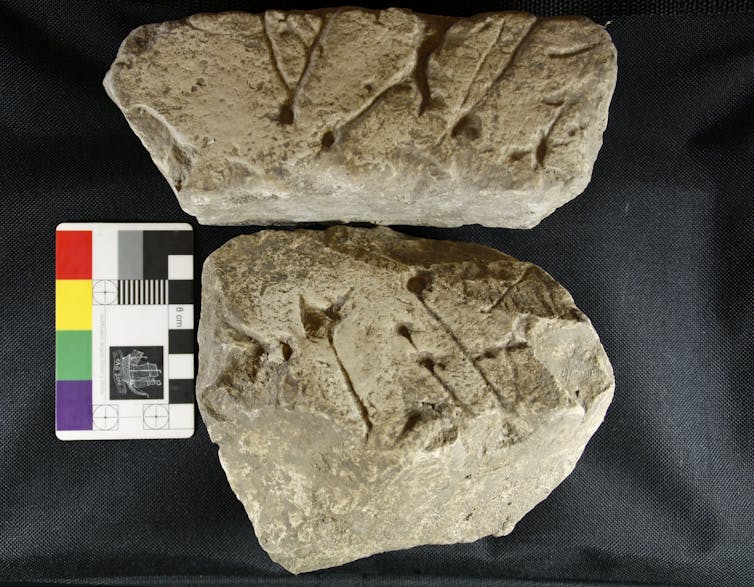
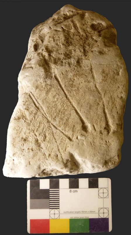
Before Aubrey's time there appears to have been a prevalent opinion that the stones were " factitious." 1 To those who were not acquainted with the valleys in the neighbourhood of Marlborough, these stones would be unlike any with which they were familiar; and the "composition" of them, where they stand, would get over any difficulty about their transport thither from a distance. The appearance, too, of some of the stones, such as of that which forms an impost of the outer circle towards the north-west, and which in its upper portion was found to consist, for the depth of a few inches, of a conglomerate of flints and sand,2 may have given strength to this opinion. There appear to have been, even recently, according to a paper of Mr. Cunnington's in 1865, some very curious notions about the sarsen portion of the Stonehenge stones. In 1836, the President of the Architectural Society had discovered, "from recent inspection, that the large stones of Stonehenge were in their granular character, closely allied to the marble of Carrara,' and another careful visitor of Stonehenge was of opinion that the stones were artificial. Mr. Sowerby, in 1812, describes the stones thus: " The outer circle and the great trilithons, with their imposts, are of sarsen3 stone, a fine-grained silicious sandstone.
" The stones of the smaller circle (except Nos. 9, 11, 17, 19, in Sir. R. Hoare's plan) are an aggregate of quartz, felspar, chlorite and horn-blende.
" No. 9 is silicious schist.
"Nos. 11, 17 19 are hornstone, with small specks of felspar and pyrites.
" The altar-stone is a fine-grained micaceous sandstone."
The Rev. W. D. Conybeare, in the Gentleman’s Magazine, vol. ciii., part. 2, p. 452, thus speaks of the small circles : " Each stone a variety of greenstone rock which occurs nowhere nearer than the environs of Dartmoor in the West, or Charnwood Forest in Leicestershire on the North ; — either being a distance of full a hundred miles in a direct line."
Professor Andrew Ramsay, writing to Dr. Thumam (1859), says : " The greenstone may possibly come from Devonshire, but such rocks are also plentiful in Montgomeryshire, in Caernarvonshire, and in Merionethshire, and around Snowdon. In fact from Cader Idris to Moel Hebog, near Bedgellert and Snowdon, and from thence by Carnedd Llewelyn to Conway. They also occur in North Pembroke- shire. My friend, Mr. Perkins, the Vicar of Wootton-under-Edge, considers that these blocks which are quite foreign to the district may have been more easily brought from Brittany, where, I believe, such rocks occur, and I think this is possibly the ease.'*''
Mr. Charles Moore, F.G.S., of Bath, in 1865, expressed his belief "that the nearest point at which they could find similar material was Wales, or possibly Shropshire, although he found stones of precisely similar character while exploring the Mendips a few months ago, but the stones could not have been obtained from that spot, for the rock had never been worked."
Professor Phillips' letter to Dr. Thurnam, giving an account of his examination of the specimens sent to him of Stonehenge stones is as follows : —

" Oxford, 22nd December, 1858.
Mr Dear Sir,
" The stones, four in number, are thus to be described: —
" 1. Marked Stonehenge altar. This is a gray sandstone, composed of quartz sand, silvery mica, and some small dark grains (possibly hornblende). Such a stone might be obtained in the gray Devonian or gray Cambrian rocks — and in other situations (' Cos.' antiq).
" 2. Greenstone (Anglice). Composed of slightly quartzose Felspar — horn-blende — a little chlorite ? &c., &c. This is an ordinary greenstone of such large grain and such, a constitution as to make approach to the green syenite of some writers. If I had better specimens I could perhaps determine the presence of other minerals. Such a rock may be found in dykes in Devonshire, in dykes and seaming beds in Wales, &c.
" 3. Smaller specimen, like the last, but with finer grain.
"4. Compact felspar of Mac Culloch: shows no internal crystallization; base of many dark porphyries — such occur in North Wales, Cumberland, &c. If on the spot, we were to study more carefully the several stones, it might, I think, be possible to identify the greenstones ; but by such little atoms as these only guesses and those very vague can be justified.
" There is nothing like granite in the specimens. This rather points to Wales than to Cornwall — nor is there any ordinary (felspathic) elvan as in Cornwall, but 'Elvan' is a name applied to greenstone dykes not unlike this stone near Dartmoor. But as, no doubt, Merlin brought the stones he might choose a rock now buried in the great depression of Caernarvonshire, where Sara Badrig alone remains to mark his tram-road !

But upon this subject, there is no one who deserves a hearing, and a more attentive hearing, too, than Mr. Cunnington, F.G.S., who has devoted so much time and thought to the study of the geological character of the Wiltshire megalithic structures. He says, in a paper " on the geology of Stonehenge," read at the Salisbury meeting of the Wilts Archaeological Society, 1865: " We are in- debted to Mr. Prestwich, the treasurer of the Geological Society, for the exact determination of the stratum from which the 'Sarsens' are derived (Vide Journal of the Geological Society).
" At the close of the secondary period of geologists, when the Chalk stratum, now forming the downs over which we shall walk to-morrow, was at the bottom of the sea, beds of sands, clays, and gravels, were deposited upon it. These constitute what are now called the tertiary strata. When they were subsequently raised above the bed of the ocean, they were exposed to the powerful de- nuding action of seas, glaciers, and rivers, by which the main portion of them, in the western district (Wiltshire included), was carried away ; a few cappings on some of the hills only remaining through the greater part of our county. Such cappings are not uncommon on some of the high hills on the borders of Salisbury Plain, es- pecially to the northward and eastward of Amesbury, and between that town, Bedwyn, and Kingsclere ; whilst hills, where no masses of tertaries remain, shew by the presence of numerous tertiary flint pebbles on their summit, the wreck of strata once spread over this area. Among the lower tertiaries (the Eocene of Sir Charles Lyell), are certain sands and mottled clays, named by Mr. Prestwich the Woolwich and Reading beds, from their being largely developed at these places, and from these he proves the sarsens to have been derived; although they are seldom found in situ, owing to the destruction of the stratum to which they belonged. They are large masses of sand concreted together by a silicious cement, and when the looser portions of the stratum were washed away, the blocks of sandy rock were left scattered over the surface of the ground.
"At Standen, near Hungerford, large masses of sarsen are found, consisting almost entirely of flints, formed into conglomerate with the sand. Flints are also common in some of the large stones forming the ancient temple of Avebury.
" At the cliffs of St. Marguerite, near Dieppe, is a bed of fine white sand, reposing unevenly upon the chalk, and extending for one or two miles in length. It contains blocks of concretionary silicious sandstone, frequently measuring many feet in length. A good example of sarsen stone in situ.
" The abundance of these remains, especially in some of the valleys of North Wilts, is very remarkable. Few persons who have not seen them can form an adequate idea of the extraordinary scene presented to the eye of the spectator, who standing on the brow of one of the hills near Clatford, sees stretching for miles before him, countless numbers of these enormous stones, occupying the middle of the valley, and winding like a mighty stream towards the south.
" Three or four small lateral valleys, containing a similar deposit, and converging to the main valley, add to the impression that almost involuntarily forces itself upon the mind, that it must be a stream of rocks, e'en now flowing onward.4
" In some places, they strew the ground so thickly, that across miles of country, a person might almost leap from stone to stone, without touching the ground on which they lie, and some of them are four or five yards across. Sometimes the masses are formed of unusually fine sand, and the result is a very dense hard rock. In this variety are commonly found the remains of what appear to he fucoids or sea weeds. They do not exhibit any very marked structure, hut are certainly vegetable. With regard to the origin of the stones composing the small circle and inner oval of Stonehenge our in- formation is less definite. They differ entirely from the sarsens, being all primary or igneous rocks. Professor Tennant, of King's College, has favored me by making a fresh examination of the speci- mens. With four exceptions, they are of syenite, composed of quartz, felspar, and hornblende. One of the exceptions is silicious schist, and the other three greenstone, containing small crystals of horn- blende and iron pyrites, the latter partly decomposed, and passing into oxide of iron. The altar-stone is a fine-grained micaceous sand- stone. Professor Ramsay, of the Geological Survey, says : 'They are certainly not drifted boulders, and do not resemble the igneous rocks of Cham wood Forest ; and without asserting that they came from Wales or Shropshire, I may state that they are of the same nature as the igneous rocks of part of the Lower Silurian region of North Pembrokeshire and of Caernarvonshire.
" Professor Tennant says that Charnwood Forest contains several kinds of greenstones and syenite, but that he never saw any of them like the stones of Stonehenge. They bear, however, he thinks, a strong resemblance to those of the Channel Islands, and it has always appeared to him that they were obtained from that source.

" But the most important consideration connected with the smaller stones, and one which in its archaeological bearing has been too much overlooked, is the fact of their having been brought from a great distance. I expressed an opinion on this subject in a lecture delivered at Devizes more than eighteen years ago, and I have been increasingly impressed with it since. I believe that these stones would not have been brought from such a distance to a spot where an abundance of building stones equally suitable in every respect already existed, unless some special or religious value had been attached to them. This goes far to prove that Stonehenge was originally a temple, and neither a monument raised to the memory of the dead, nor an astronomical calendar or almanac. In either of these latter cases there would have been no motive for seeking the materials elsewhere. The sarsens would have answered every purpose, with less labour, and with better effect. But, if these were the sacred stones of some early colonists, a superstitious value would have been attached to them, and great care and labour bestowed on their preservation. Thus the ancient so-called ' Stone of Destiny,' on which our sovereigns are crowned, was preserved with pious care for centuries in the Abbey of Scone, and has, to this day, its place in the Coronation Chair at "Westminster Abbey.
" It has been suggested that they were Danams, or the offerings of successive votaries. Would there in such case have been such uniformity of design or would they have been all alike of foreign materials? I would make one remark about the small impost of a trilithon of syenite, now lying prostrate within the circle. One writer has followed another in taking it for granted that there must have been a second, corresponding with it, on the opposite side. Of this there is neither proof nor record, not a trace of one having been seen by any person who has written on the subject. This small impost, not being of sarsen, but syenite, must have belonged to the original old circle, and it may even have suggested to the builders of the present Stonehenge the idea of the large imposts and trilithons, with their tenons and mortices.
" It is important to mention that no iron implements have been found in the numerous barrows around Stonehenge."

1 The author of a " Fool's Bolt '' strongly asserts their being saxa factitia, as " it was impossible to work them into their several forms. Free-stones may be wrought to any, but these churlish stones to no form in cause of hardness and brittleness."
2 See Wilts Magazine, vol. xi., p. 348. Mr. Cunnington adds to this account, the following statement : " Masses of sarsen made up entirely of a similar conglomerate of chalk-flints frequently occur in the neighbourhood of Standen, near Hungerford, but they are not found in the middle or southern districts of Wilts."
3 In the Addenda and Notes to " Abury Illustrated," the following is given as an explanation of the word " Sarsen : " " The term Sarsen, or Saresyn, was applied by the Anglo-Saxons, simply in the sense of Pagan, to the stones which they found scattered about the Wiltshire Downs. As all the principal specimens of these mysterious blocks were perceived to be congregated into temples popu- larly attributed to heathen worship, it naturally came to pass that the entire formation acquired the distinctive appellation of Sarsen or Pagan stones. The same epithet of ' Saresyn ' the Saxons also applied to their invaders the Danes or Northmen, who, on their coming into this country, were universally pagan. Thus Robert Ricart (quoted in Roberts' History of Lyme) says, ' Duke Rollo Le Fort was a Saresyn come out of Denmark into France ; ' and a spot in Guernsey is still designated by the same term from having constituted the temporary stronghold of certain Norman freebooters." — Waylen's History of Marlborough, p. 529.
The following is from Mr. Henry Lawes Long's ' ' Survey of the Early Geography of Western Europe : " " In addition to the suggestion advanced that our word Sarsen, as applied to the Druid sandstone, is, in fact, a corruption of Saracen, I may add that Sarrasin is the name commonly given on the Continent to ancient objects whether of Celtic or Roman construction, thereby inferring a period anterior to any remains of Christian origin. Roman denarii, which in the north of France still occasionally are current as sous, bear the name of Sarrnsins. The Roman bridge near Aosta is called the Pont de Sarrasins." And I may add the following extract from the " Journal de I'Architecture," (of Brussels,) 4"". annee, p. 84 : " Les traditions locales attribuent la con- struction des chaussees romaines aux Sarrasins. Les mines, les tuiles antiques, les poteries, les medailles, etc., que Ton trouve chaque jour, ne sont connus, comme on salt, que sous les noms de Masures, de Vahes, de JiJonnaies, ou de puits des Sarrasins, Cette denomination remonte evidemment aux temps des Croisades, lorsque les esprits etaient remplis du nom des infideles. Du reste, les armees et les populations qui revenaient de Terre-Sainte, en suivant les chaussees romaines, n'auront pas peu contribue a repandre aux environs I'epithete injurieuse de Sarrasin et de payen, dans laquelle ils auront confondu les Romaines si, comme il est probable, un faible souvenir de ce grand peuple vivait encore a cette epoque dans le souvenir de nos peres." Mr. Long quotes the following from Col. Symonds's Diary, which his cousin, Mr. C. E. Long, edited for the Camden Society: " 12"' Nov. 1644, Tuesday, though a miserable wett windy day, the army moved over the playnes to Marlingsborough, where the King lay at the Lord Seymour's howse, the troopes to Fyfield, two myles distant, a so full of a grey pibble stone of great bigness as is not usually seene ; they breake them, and build their howses of them and walls, laying mosse betweene, the inhabaitants calling them Saracen's stones, and in this parish a myle and halfe in length, they lye so thick as you may goe upon them all the way. They call that place the Grey -weathers, because a far-off they looke like a flock of sheep”.

4 These stones are now rapidly disappearing ; they are used for building purposes.


Tuesday 7 November 2017

A303 Boreholes Show The Planned Route

The excellent BGS webpage Geology of Britain has links to borehole reports as well as to the underlying geology.


http://mapapps.bgs.ac.uk/geologyofbritain/home.html


Or in 3D - http://mapapps.bgs.ac.uk/geologyofbritain3d/index.html


Click to enlarge.

If you try the links on the new boreholes to the north of Winterbourne Stoke (on the BGS website) it shows they are from the Stage 2 of the A303 investigation and the results aren't available (yet?) and some are confidential...

But I think we can see the routes they are thinking of.

The bright green splodges are the phosphatic chalk deposits.

Wednesday 25 October 2017

Did Marden Henge go South of the River?

From The Ancient History of Wiltshire, Volume 2 Sir Richard Colt Hoare


.. the sudden disappearance of the bank and ditch at D, has caused much debate and inquiry amongst us. Mr. Cunnington was of opinion that the bank did not cross the brook, but proceeded in a line from A towards D; but the Rev. Mr. Charles Mayo, residing at Beauchamp Stoke, whose father first took notice of these works, after a frequent and very minute investigation of this ground; thought otherwise, and was decidedly of opinion, that the original vallum extended across the present water meadows to the high ground marked E. E. E. E. Some ingenious remarks which he kindly communicated to me by letter, induced us to re-examine the ground very minutely with my surveyor and draughtsman, Mr. Philip Crocker; and we were both of opinion that Mr. Mayo was right in his. conjectures respecting both the direction and extent of this bank and ditch. On examining the southern circumvallation of this earthen work, we were struck with the: singularity of that part of the works marked F, which appeared as if intended for an, approach or entrance into the area of the circle ; and this idea was in a great degree corroborated by the circumstance of our discovering the site of a British village on 'some high ground not far distant.


(The Reverend Charles Mayo, son of John, had written to Cunnington to persuade him that the earthwork crossed the river, but the latter was not convinced so Mayo complained to Hoare. ‘Poor Mr Cunnington was I think mistaken in his idea of the extent of the [bank] mound’, but having carefully investigated the south bank of the river on three separate occasions Cunnington found no evidence that the earthwork crossed to the other side and was not convinced. Instead, he believed that that enclosure was bounded in the south along the line of the river bluff. Hoare, however, visited the site and, having noted the British Village on the southern bank, sided with Mayo in the matter. - Historic England - The Hatfield Earthworks, Marden, Wiltshire: Survey and Investigation - David Field, Louise Martin and Helen Winton )

Dr Jim Leary who lead the recent investigations of the henge is adamant that the answer is "no" after a major investigation of the question. "We investigated this in detail as part of the Marden project - first with aerial survey and LiDAR, and then on the ground with topographic survey and coring. Absolutely not a bank and ditch. It is the scarp of the natural bluff which has been enhanced by ploughing (ie a lynchet). Almost certainly part of the medieval open fields. This suggestion crops up with surprising regularity- about once every two years."


Lidar map annotated with Colt Hoare's letters.


Click images to embiggen

Better Lidar images from Mark Walters‏ @MarkWalters_ thanks to whom for permission to reproduce them and to the Environment Agency as the source of the original LIDAR data.


Click to embiggen

It is noticeable how the henge bank finishes to the west of the road and that the curve of modern houses north of the river are not on the outer henge bank as is often assumed.

As Colt Hoare was a meticulous recorder and he investigated this carefully I thought it worth a peak.

South of Marden Mill to the west of the road the field is ploughed and very sandy, (with a few interesting flints on the surface), as we know from the Hatfield Barrow sandy lumps can disappear here when ploughed but there might just be a slight rise visible. Looking towards the east from the footpath there the weeds show a band where he marks the bank.

To the east of the road the field is permanent pasture and the field is full of bumps. There are obvious platforms over the bank feature, Colt Hoare marks it as a British Village. But my impression from a swift look is that the natural features have been enhanced with a bank that follows round above the river.


Swallowhead Spring, Hoare's Different Position


From The Ancient History of Wiltshire, Volume 2 Sir Richard Colt Hoare (Click to enlarge)

Probably just an error but I found it interesting that he marks Swallowhead Spring in  a different position to where even the earliest Ordnance Survey map places it, on the elbow where the nascent Kennet turns east.

The spring he marks has an interesting history of changes and infilling, and probably has a much richer buried history than any the other one.


Sunday 15 October 2017

Stonehenge Visitor Centre Water Supply - The Results

As detailed in a previous post  http://www.sarsen.org/2017/02/the-water-supply-at-stonehenge-visitor.html I have been trying to understand rumours of unsatisfactory water test results at the New Visitor Centre near Stonehenge operated by English Heritage.

My first FOI request to Wiltshire Council
https://www.whatdotheyknow.com/request/private_water_supply_quality_at failed to turn up the test results that the legislation demands and also worryingly few other documents.

Another FOI request has turned up more documents and the test results that the Council apologise for failing to provide the first time.
https://www.whatdotheyknow.com/request/stonehenge_visitor_centre_privat

I might think that the testing schedule by the Council is not as rigorous as my reading of the legislation suggests it should be and that the correspondence that should be filed and accessible has not been found but I'm pleased to see the results they have produced.

One minor point is that the water will be tested for Radon later this year which should reassure the Radiophobes.

As someone who was working at the centre in 2014 I am more concerned that there was a breakdown in the Nitrate Removal system for an unknown time and that I was not informed of it at the time, I don't think any of the other staff were informed either.

Further reassurance that increased precautions have been taken, and that the problems identified as giving the supply a "High Risk" of contamination when it was first assessed have been addressed, would be welcome as they do not show up in the FOI records.


Click to enlarge


Sunday 24 September 2017

The Water Supply at the Stonehenge Visitor Centre


The Sun on Sunday 12/2/2017 picked up on an FOI request I had made as a friend of mine who worked at the centre has recently gone on Maternity Leave and I was in a position to ask questions she felt might compromise her position.


As we enter a restaurant we can be reassured of the hygiene of the kitchen by the Food Agency’s public star ratings. But what about the water that is used for cooking, making drinks and served to drink? For the vast majority of premises this is not a problem as we can rely on the public water supply. But out in the countryside many large estates and their visitor centres as well as small remote homes use their own private water supply. There are strict rules on the testing of the water by the local authority but the results are not readily available to the staff and customers.

As an example the New Visitor Centre near Stonehenge has been open for over three years and uses a private borehole to supply all its water. Shortly after its opening Wiltshire Council condemned the design and implementation of the borehole as being at “High Risk” of becoming contaminated.


"There are a number of areas where the supply system does not meet the guidelines set by the Drinking Water Inspectorate ie. chamber cover is not lockable, chamber  walls do not extend 150mm above the surrounding ground height. no barrier to divert surface  flows away from the chamber, no protective fence. These deficiencies lead to the risk rating of 'High Risk'. We strongly recommend that you take steps to address these matters." 

With a licenced extraction of 35m3 a day the local authority should now, under The Private Water Supplies (England) Regulations 2016, be testing the water at least twice a year for fifteen parameters. But even though four million visitors have used the facility in that time an FOI request reveals that the council only have one test on record from 2014 and that is just for nitrates, which show a worrying 46.9 mg/l where the legal limit is 50mg/l. Worrying because nitrate levels vary with the season.

UPDATE 24/9/17 - I have requested updated test results and risk assessments from Wiltshire Council as it is over a year since The Private Water Supplies (England) Regulations 2016   came into force and the water should have been tested twice.

The detailed examination of the geology under the Stonehenge World Heritage Site for the tunnel plans has revealed that there are bands of radon containing phosphatic chalk underground. Is the water at the visitor centre being drawn from one of them? We, the general public, don’t know. The borehole is adjacent to the coach park, has there been contamination from surface waters? We don’t know. Are the nitrate levels safe this year for bottle-fed infants? We just don’t know. We should so we can make informed choices when we visit or work in premises supplied by private water supplies. The test results should be made public and displayed on the premises.

The Council warning and test results upt to January 2017 are at https://www.whatdotheyknow.com/request/private_water_supply_quality_at
There is no correspondence showing whether the risk concerns have been addressed.

The Private Water Supply regulation and testing requirements are at http://www.dwi.gov.uk/private-water-supply/regs-guidance/Guidance/info-notes/england/reg-9.pdf and http://www.legislation.gov.uk/uksi/2016/618/schedule/2/made

Advice on nitrates is in: http://www.dwi.gov.uk/stakeholders/guidance-and-codes-of-practice/pws-nitrates.pdf

The radon problem is detailed in http://www.tunneltalk.com/UK-21Nov2014-Stonehenge-TBM-bored-road-traffic-tunnel-revived.php

The private water supply is detailed in a planning document https://goo.gl/ZYXMmB

Potable water for the site is taken from an existing bore hole. There is currently an abstraction licence in place with the Environment Agency, licence number SW/043/0021/003: for the period 17th May2013 to 17 May 2025, which confirms the agreed maximum abstraction rates as being: 3m3 per hour, 35m3 per day, 2,837m3/year with a maximum continuous extraction rate of 2l/s. Following a period of monitoring of the operational site, a revised application for a small increase in peak requirements is currently awaiting approval, the application being submitted November 2015.


http://unidoc.wiltshire.gov.uk/UniDoc/Document/File/MTYvMDM5ODgvRlVMLDgwNjg3OA==

"There is no mains water or sewerage so the site utilises local groundwater for drinking water, washing water and temperature control while also being a receptor for treated sewage effluent. Any exceedances of the permit and licence limits have potential to cause environmental harm and would be a breach of environmental legislation. We note a proposed increase in visitor numbers. This will require a variation to the existing Permits (abstraction and discharge). These permit variations need to be secured, and process plant and any associated environment management scheme shown to be fully operational, before any planning condition relating to this activity is discharged. This is given the background of poor permit compliance at the site during and following the original site commissioning during 2014/15" -: Environment Agency

http://unidoc.wiltshire.gov.uk/UniDoc/Document/File/MTYvMDM5ODgvRlVMLDcyODM5MQ==

"The proposal contains information (Appendix D) on surface water and foul water drainage which has the potential to detrimentally affect groundwater. An increase in visitor numbers and toilet facilities is proposed, which could affect compliance with existing Environmental Permits and authorisations (sewage effluent discharge EPR/DB 3593NA, ground water heating discharge EPR/YP3926GR and abstractions for potable water and groundwater heating and cooling SW/043/0021/003). In addition there is an increased pollution risk from oil spills or leaks from the proposed enlarged parking area."


Monday 18 September 2017

A344 Permissive Path - Open by 1st Oct 2017


Visitors enjoying the Permissive Path on the Route of the old A344 at Stonehenge


From: Davies, Jennifer
Sent: 07 September 2017 08:48

Subject: RE: Stonehenge Permissive Path


All is in hand and the path will indeed be open on or before the 1st October.

We have the open access period of Autumn Equinox to consider on 23rd September when it wouldn’t be appropriate to be moving fences etc at the time but all plans are ready.

We look forward to seeing Mr West and his fellow cyclists on the 1st.

Kind regards

Jenny


Jennifer Davies | Head of Operations | Stonehenge

English Heritage, Stonehenge Visitor Centre
Amesbury, Salisbury, Wiltshire, SP4 7DE


Full details of the Permissive Path are in the Wiltshire Council planning application S/2009/1527

The Phasing of Works Document 
(http://unidoc.wiltshire.gov.uk/UniDoc/Document/File/Uy8yMDA5LzE1MjcsNjk5MTI4) has these details:

8.0 PHASE 4 – STONEHENGE BOTTOM – SUMMER 2016

This phase involves the release of the re-vegetated A344 area. Please refer to Figure 7 for details.


The existing/temporary stock fence and gates to the north of the original A344 are to be removed and turf used to patch any resulting disturbances in the grass surface. The areas of the permissible route that are formed using the ground reinforcement system are to be removed and patched using turf grown off site.

The permissible route is now along the northern edge of the re-vegetated A344.

9.0 PHASE 4 - STONE MONUMENT – SUMMER 2016

This phase involves the release of the re-vegetated A344 area. Please refer to Figure 8 for
details.


Click plans to enlarge.

The existing bridge over The Avenue and areas of reinforced grass to the west and east of the bridge are to be removed and patched using species rich chalk grass turf grown off site.
The temporary barriers/fence, such as rope barriers, to the grassed A344 is removed.

The existing stock fence to the north of the A344 and around the former car park and hub facilities is removed and grass is patched with turf as needed to make the grass surface good.

The final configuration of the temporary barrier/fence, such as rope barrier, for visitor circulation is formed into its final functioning arrangement.

Tuesday 12 September 2017

Details of the Stonehenge Tunnel Preferred Route Option 1Nd

From Highways England:

Based on the detailed WebTAG assessment and appraisal of the modified route options following the public consultation (January–March 2017), the recommended Preferred Route for the A303 Stonehenge scheme is Option 1Nd


The Options:

Option 1Na – As per previous Option 1N but with a local horizontal realignment to the west of the WHS through Oatlands Hill and across the existing A303; with an approximate 2.9km long tunnel and 300m cut and cover tunnel extension at the western portal within the WHS; and with the new road in cutting between the western tunnel portal and the western boundary of the WHS. The new A360 junction would be located close to the crossing of the existing A303 as with Option 1N, with the existing Longbarrow Roundabout replaced by a simple ‘T’ junction.

Option 1Nd – A variation on Option 1N with a similar approximate 2.9km long tunnel and 300m cut and cover tunnel extension at the western portal within the WHS but with the western portal moved north to a location just to the south of the existing A303 and with the new road in cutting between the western tunnel portal and the western boundary of the WHS. The new A360 junction would be located closer to the existing A360 than with Option 1N, replacing the existing Longbarrow Roundabout.

Option 1Sa – As per previous Option 1S with a similar approximate 2.9km long tunnel and a 300m cut and cover tunnel extension at the western portal within the WHS and with the new road in cutting between the western tunnel portal and the western boundary of the WHS and The Park to the west. The new A360 junction would be located close to the existing A360 within The Park as with Option 1S.


Click to enlarge pictures

In relation the historic environment, the preferred alignment is Option 1Nd as this
route:
• Facilitates a preferred exit location from the WHS, avoiding the Winter
Solstice Sunset alignment (Option 1Sa) and the need for a large cutting
through Oatlands Hill (Option 1Na).
• Runs closer to the current A303, minimising wider intrusion and disturbance.
• Provides more opportunities for effective mitigation than Options 1Na and
1Sa, ensuring overall benefits to the WHS through the removal of much of
the existing A303.
17.1.14 For the wider environment and local community, the route alignment of Option 1Nd
is assessed to result in a lesser impact on a number of key environmental
receptors, as follows:
• It presents a lower risk of adverse effects to the River Avon SAC/River Till
SSSI, and the aquatic ecology of the River Till, when compared with Option
1Sa which would cross the River Till at a location which is considered more
likely to support the qualifying species for the River Avon SAC, as well as
other protected and notable species.
• It avoids impacting what is considered to be a more complex valley
landscape to the south of Winterbourne Stoke that would be affected by
Option 1Sa, and affects the visual amenity of fewer residential and leisure
A303 Stonehenge - Amesbury to Berwick Down | HE551506
PAGE 268 OF 290
receptors in the vicinity of Winterbourne Stoke and Berwick St James than
would be affected by Option 1Sa.
• It avoids direct impacts on landscape features such as The Diamond and
the wooded enclosure within The Park, and is located further away from the
RSPB Normanton Down Nature Reserve, reducing the potential for adverse
effects on protected and notable species, including Stone Curlew, when
compared with Options 1Na and 1Sa.
• It is located closer to the current A303 infrastructure than Options 1Na and
1Sa, thereby creating less disturbance from the effects of traffic.


Monday 11 September 2017

Stonehenge Tunnel Preferred Route

Highways England Update 11 Sep 2017 on the Stonehenge Tunnel


https://highwaysengland.citizenspace.com/cip/a303-stonehenge/


Our first (non-statutory) public consultation on proposed options took place from 12 January to 5 March 2017.

Following our thorough analysis of all the responses to the consultation on proposed options, as well as undertaking further surveys and assessments, the Secretary of State for Transport announced the preferred route for the A303 between Amesbury and Berwick Down with the following features:

• A new junction between the A303 and A345 accommodating free-flowing traffic movements between both roads
• A twin-bore tunnel, at least 1.8 miles (2.9 kilometres) long, past Stonehenge
• A new junction to the west of and outside the World Heritage Site (WHS) accommodating free-flowing A303 and A360 traffic movements, as well as a link to Winterbourne Stoke
• A bypass to the north of Winterbourne Stoke
More details of the preferred route including how we have read and considered every response, can be found provided in the documents below.

Files:
Moving forward - the preferred route, 4.2 MB (PDF document)


Preferred route plan - simple version, 679.4 kB (JPEG image)


Preferred route plan - detailed version, 730.4 kB (JPEG image)


The 2016 update of the mapping of the World Heritage Site


The 2016 update of the mapping of the World Heritage Site, highlighting the density of archaeological features identified both from thousands of aerial images dating back as far as 1906, and recent lidar imagery. The yellow line marks the current WHS boundary. © Historic England

The full image is available at:
https://content.historicengland.org.uk/remote/content.historicengland.org.uk/content/images-books/images/2283256/her-6/aerial-stonhenge-banner

(cunning use of Stonhenge in the URL...)

Tuesday 29 August 2017

Stonehenge 1938

Apart from a date of 1938 written on the back I have no more information about these snaps.